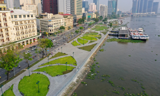
HCMC aims to build 42 parks along Saigon River
This initiative is part of the city’s project to develop riverside service economy by 2045.
The project covers the Saigon River corridor passing through Thu Duc City, Districts 1, 4, 7, 12, Binh Thanh, and the two suburban districts of Cu Chi and Hoc Mon. The development strategy focuses on integrating multi-functional green infrastructure to enhance connectivity and align with HCMC’s overall master plan adjustments.
These parks are designed to capitalize on the Saigon River’s potential, fostering a service economy while enhancing the city’s landscape.
The plan, based on expert consultations and research, involves phased implementation, coordinated with riverside infrastructure in various regions, according to the city People’s Committee.
The Saigon River stretches 256 kilometers, originating in Binh Phuoc Province and passing through Tay Ninh, Binh Duong, and HCMC.
Within HCMC, the river spans 80 kilometers, winding through the city and creating key peninsulas like Thanh Da and Thu Thiem. The river’s inner-city section hosts only a few parks, including Bach Dang Park, a riverside park in Thu Thiem, and the park within Vinhomes Central Park, a privately-owned complex.
HCMC currently has around 400 parks, including public parks and those within residential areas, with over 235,000 trees. The city’s central districts feature larger park areas compared to suburban districts.
The planned green park area for the city is over 11,400 hectares, equivalent to seven square meters per person. However, the existing park area is only about 500 hectares, resulting in an actual ratio of 0.55 square meters per person for a population of over ten million.


Comments are closed.