
 Vishal Jaiswal
Vishal Jaiswal has been flying drones since he was young.
Now 27, that childhood hobby has become his profession. A recent project involved mapping part of the Sundarbans, a vast area of mangrove forests where the waters of the Ganges, Brahmaputra and Meghna rivers spill into the Bay of Bengal.
Covering more than 4,000 sq miles (10,360 sq km) of coastal India and Bangladesh, it is the world’s biggest area of mangroves.
“It’s a very dense area with mix of everything, including forests with wild animals,” says Mr Jaiswal.
Along with two other team members he mapped 150 sq km in three days.
“A trained and skilled person is needed to fly a drone in thick mangroves area,” he says.
“It was a difficult task. We mapped the area from deep inside the forest, travelling there on boats and roads.”
It was one of many projects aimed at protecting the mangrove forest from the effects of climate change and human activities.
Globally, more than half of all mangrove ecosystems are at risk of collapse by 2050, according to a recent report from the International Union for Conservation of Nature (IUCN).
“Mangroves are threatened by deforestation, development, pollution, and dam construction, but the risk to these ecosystems is increasing due to sea-level rise and the increased frequency of severe storms associated with climate change,” the report said.
In India the picture is mixed.
The mangroves of South India, Sri Lanka and Maldives are “critically endangered,” according to the IUCN report.

 Getty Images
Other Indian mangroves are not on that “red list”.
The Sundarbans are one of those mangroves not considered endangered by the (IUCN).
However, Dr Sahadev Sharma, a consultant scientist to the USDA Forestry Service, says there are signs of both manmade and natural stress, which he identified during his field survey beginning of this year.
“We are seeing a loss in dense mangrove cover in Sundarbans. Additionally, patches on the western coast are extremely fragmented and eroded due to shrimp farming and development,” he says.
But it’s hard for scientists to know exactly what’s happening to the Sundarbans. There’s a lack of field research, partly because it’s a difficult place to work.
“It requires coordination with officers and ground staff, procuring field supplies in remote areas, and planning extensive logistics for field operations.
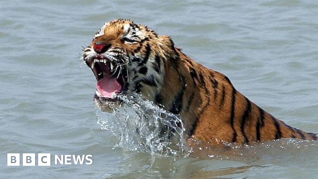
“The risk of saltwater crocodiles and Bengal tigers, tides and treacherous terrain make the field work even more difficult,” he says.
So, scientists are turning to tech, like Mr Jaiswal’s drones, to monitor the mangroves.
One key bit of information needed is the height of the mangroves in relation to the sea level.
The rivers flooding into the Sundarbans dump sediment, raising the ground level.
But if the sea level rises faster than that soil building process, then the mangroves will be threatened.
This process is monitored by installing rSETs (rod surface elevation tables) across mangrove forests.
 Sharma
The first part of the process is to drive steel rods into the mud, to provide a base for the measuring equipment.
Then Lidar scanners are attached to the top of the rods. These use lasers to scan the ground up to 2m away from the central rod, taking hundreds of thousands of extremely accurate measurements.
It’s a big improvement on the previous system, which involved attaching cumbersome fibreglass arms to the rods, which were extended to take height measurements.
That method would take hours to produce just 36 measurements and relied on the user placing the arms in the exact same positions as previous surveys.
“Because we are using a laser, there is minimal human error and the precision of this method is much greater than the traditional pin methods,” says Mr Sharma.
But it has one drawback – it’s more expensive than the old way.
Nevertheless, the project is making progress with the help of local partners.
Measuring sites are in place in the Andaman Islands, Sundarbans and Coringa and there are plans to install more in Bhitarkanika National Park, Orissa.
The research is still in its early days, they have a few data sets, but are waiting for the water level to recede before they can start measuring in the Sundarbans.
 Getty Images
Many who live in the coastal regions that support mangrove forests rely on them for survival.
In Andhra Pradesh, which has a long coastline in eastern India, fisherman Laxman Anna blamed the destruction of mangroves for poor catches.
“A few years back it had become a frustrating job. Going into the creek to catch fish and coming back empty handed.”
“Imagine a day when I made just 60 cents for my entire day in the creek, as there were no fishes. Barely enough to sustain my family of five.”
He blamed shrimp farms for upsetting the ecosystem.
But Mr Anna says communities in his area have realised the importance of preserving the mangroves.
“We are planting saplings, nurturing them back to life with help of an NGO and the forest department.”
And that effort is paying off.
“Things are changing I have a smile on my face when I go to fishing now. I am able to get a good catch and make around seven to eight dollars a day, which is a good catch for my survival.”
Comments are closed.