
Cyclone Dana: Deep depression to become cyclonic storm in 12 hours; landfall in Odisha tomorrow
The deep depression over the Bay of Bengal is likely to become a cyclonic storm in the next 12 hours before turning into a severe cyclonic storm that will make landfall in Odisha between Thursday night and Friday.
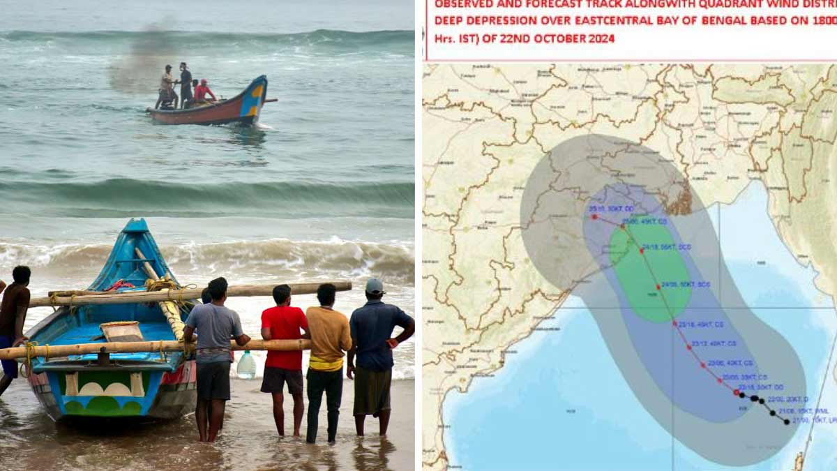
The latest update from IMD said that the deep depression had moved west-northwest with a speed of 3 kmph and is centred about 670 km from Paradip in Odisha and 732 km from West Bengal’s Sagar Island.
“It is very likely to intensify into a severe cyclonic storm over northwest Bay of Bengal by Thursday morning and cross Odisha and West Bengal coasts between Puri and Sagar Island during Thursday night to Friday morning with a windspeed of 100-110 kmph, gusting 120 kmph,” the alert added.
While the northern districts of Odisha are on alert, expert predict the landfall would likely be between Bhitarkanika in Kendrapada and Dhamra in Bhadrak on Thursday night.
Centre for Environment and Climate (CEC) director Dr Sarat Chandra Sahu said the cyclonic storm is likely to cross the Odisha coast tomorrow night. “The landfall is expected to be somewhere in the coastal reaches of Kendrapada and Bhadrak districts,” he told Odisha bytes.
He added that Bhubaneswar city and nearby areas will witness winds with a speed of 55 to 70 kmph from Thursday night till Friday evening. Bhadrak, Jajpur, Kendrapara, Khurda, Cuttack, Puri, Nayagarh and Ganjam will witness continuous rain that will continue till Saturday.
Meanwhile, half of Odisha’s population is likely to be affected by the impending cyclone that could cross the east coast. Odisha Revenue, and Disaster Management Minister Suresh Pujari said over 5,000 relief centres have been set up and they are expecting evacuation of around 10 lakh people.
The state government has planned the evacuation of 3,000 villages in 14 districts to relief camps.
The government has ensured round-the-clock power supply in association with Tata Energy. The telecom department has assured that the telecom network will be intact.
Several trains have been cancelled in the wake of the cyclone. Train No. 06087 from Tirunelveli Junction – Shalimar Special scheduled to leave Tirunelveli on October 24 has been cancelled. The train from Bhubaneswar to Rameswaram (Rmanathapuram), Superfast Express scheduled to leave Bhubaneswar on October 25 has been cancelled.
All educational institutions including schools, colleges and universities will remain closed in 14 districts of Odisha from Wednesday to Saurday in view of the impending cyclone.
West Bengal
The West Bengal government too announced that schools and academic institutions will remain closed in various parts of the state. Chief Minister Mamata Banerjee said her government is ready to face the cyclone.
The National Disaster Response Force (NDRF) and State Disaster Response Force (SDRF) teams have already been deployed across vulnerable areas which include South 24 Parganas, North 24 Parganas, and Purba Medinipur, along with coastal areas and neighbouring districts like Paschim Medinipur, Bankura, Jhargram, and Hooghly.
“Integrated control rooms have also been established at both state and district levels, functioning 24/7 to monitor the situation,” Banerjee said, adding that those who live in low-lying areas will be shifted.
Comments are closed.