
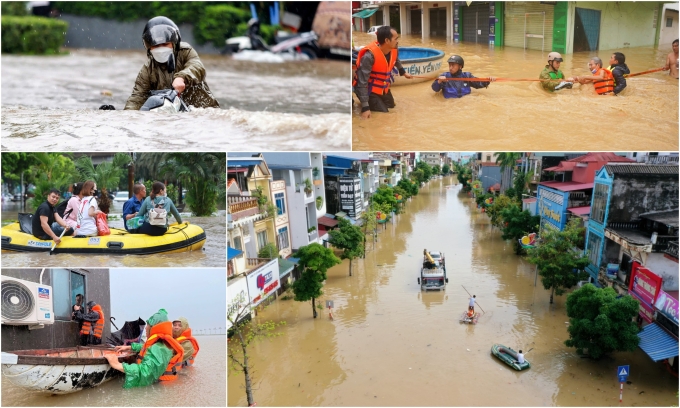
Vietnam endured a year of unprecedented meteorological crises in 2025, as record-breaking rainfall and historic tides triggered disasters that overwhelmed infrastructure across the nation.
Record unseasonal rainfall in Ho Chi Minh City
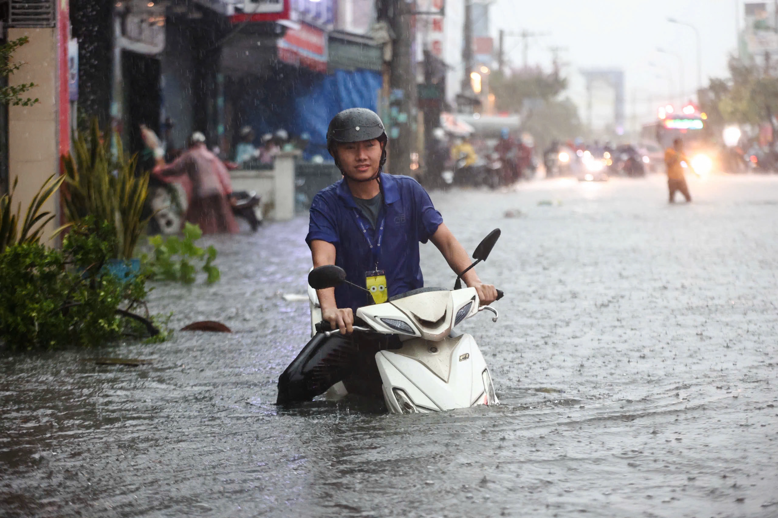
Two weeks after the Lunar New Year, Ho Chi Minh City and its southern neighbors received the heaviest unseasonal rainfall in two decades. The downpour persisted for four to five hours from early morning of Feb. 13 until around 8 a.m., leading to severe inundation in multiple areas across HCMC, Binh Duong and Dong Nai, paralyzing traffic and left streets in chaos.
Le Dinh Quyet, head of forecasting at the Southern Regional Hydrometeorological Center, said rainfall from Feb. 12 night to early Feb. 13 reached over 126 mm in Long Thanh District of Dong Nai and 124 mm in Nha Be District in HCMC.
He said unseasonal rainfall exceeding 100 mm at a time is extremely rare, with no similar event recorded in southern Vietnam in the past 20 years. The heavy rain was triggered by atmospheric disturbances caused by a tropical depression.
On May 10, the city experienced its heaviest single downpour in eight years when nearly 230 mm of rain fell in just 90 minutes. This intense, short-duration rainfall caused widespread, severe flooding across various districts.
Quyet attributed the event to a powerful southwest wind pulling moisture inland, intensified by a low-pressure trough.

Click để lật ảnh
Click để lật ảnh
The water rose nearly to the height of motorcycle seats, causing many vehicles to stall, leaving only buses able to move in the vicinity around Thu Duc Market, including nearby streets like Vo Van Ngan and Dang Thi Danh. Photos by Read/Quynh Tran, Thanh Tung
Historic high tides
Ho Chi Minh City and its surrounding areas recorded historic tidal levels in October and November, shattering previous records and leaving low-lying districts vulnerable to severe inundation.
New records set at monitoring stations on the Saigon River confirms that water levels have surpassed historical benchmarks, according to the city’s Department of Agriculture and Environment.
At Phu An Station, the tide peaked on Oct. 23–24 at 1.77 m, matching the historical record from September 2019. However, levels continued to rise in November, hitting a new all-time high of 1.78 meters at 4:00 a.m. on Nov. 6.

At Thu Dau Mot Station, which is further upstream, the surge was even more pronounced. On Oct. 24, the tide reached 1.87 meters, exceeding the previous peak set in October 2024 by 7 cm. By Nov. 6, it climbed to 1.88 meters, setting another new historical record.
The record high tides coincided with the peak of the seasonal rainy season, overwhelming the city’s drainage capacity. This combination turned major thoroughfares into rivers, paralyzing traffic during rush hours.
Key arteries such as Tran Xuan Soan, Huynh Tan Phat, Le Van Luong in the former District 7, and National Highway 50 in the former Binh Chanh District were submerged under knee-deep water, forcing motorcyclists to push stalled vehicles through the deluge.

Groups of foreign tourists drinking on sidewalks, keeping their feet on tables as water lapped 10–20 centimeters high on Bui Vien walking street, one of Ho Chi Minh City’s busiest nightlife hubs, on Nov. 8, 2025. Photo by Read/Gia Minh
Water inundated homes and disrupted daily life for many in the Binh Quoi and Thanh Da areas of the former Thu Duc City as well as those in the former District 8 and Nha Be District.
In the city center, iconic areas like the Bui Vien walking street and Calmette Street also faced rare, deep inundation, disrupting local businesses and tourism.
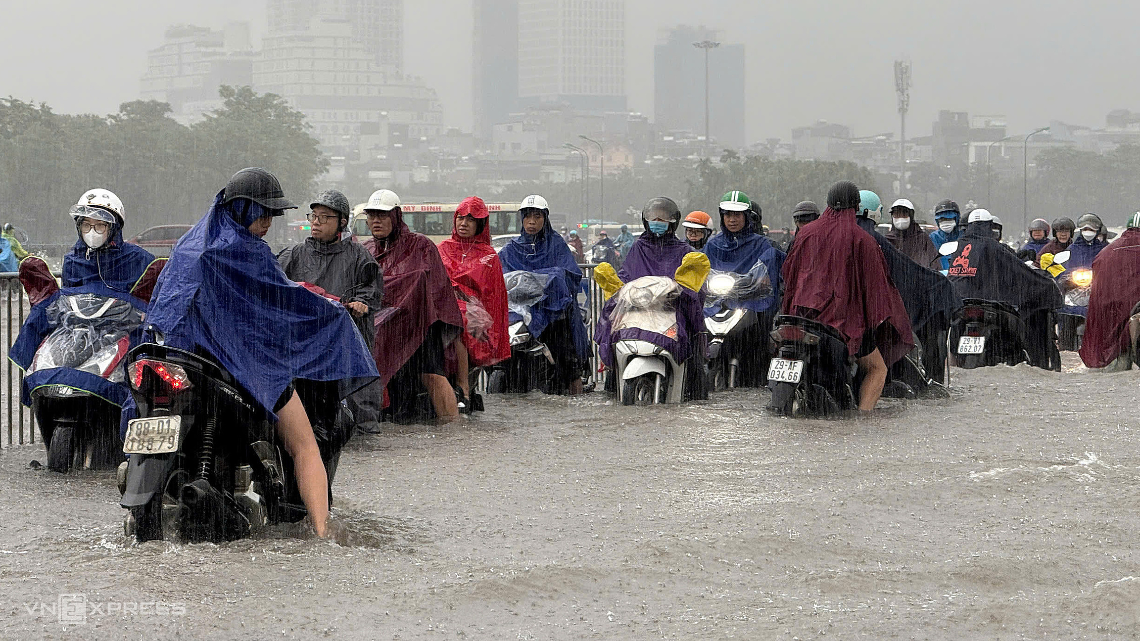
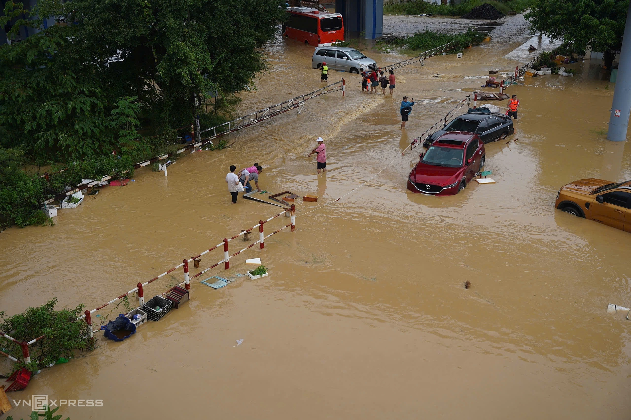
Widespread flooding in Hanoi
Hanoi experienced multiple episodes of prolonged flooding this autumn caused by storms, resulting in severe losses and disruption of people’s lives.
On Aug. 26 a downpour from the previous night brought by Typhoon Kajiki inundated downtown streets such as Nguyen Trai, Truong Chinh, Minh Khai, Nguyen Xien, and Vo Chi Cong.

Floods and traffic jams on Vo Chi Cong Street, Aug. 26, 2025. Video by Van Ngoc
The water levels reached a meter in some areas, causing motorbikes and cars to stall en masse on roads.
Traffic on National Highway 6, a key route linking Hanoi with the northwest, ground to a halt as water submerged vehicles bumper-deep.
On Vo Chi Cong Street, there was a four-kilometer traffic jam on the direction leading from Noi Bai airport to downtown Hanoi. Commuters spent hours stranded, with some turning to the metro or wading through waist-deep water to reach work.
On Sept. 30 the city received the heaviest downpour in decades, one far exceeding its drainage network’s capacity, and many streets and residential areas remained flooded until Oct. 1, forcing the military to send personnel to ensure the safe passage of vehicles and people in affected areas.
According to the city’s Department of Construction, Typhoon Bualoi brought rains of 120 mm to over 600 mm from late Oct. 29 to Oct. 30. Some spots saw exceptional levels, including 616 mm at O Cho Dua and 503 mm at Hai Ba Trung, he said. This was the highest in decades, even surpassing the 2008 deluge.
The downpour, it said, was far exceeding the capacity of the drainage system.
On Oct. 7 there was more severe flooding, this one caused by Typhoon Matmo, which paralyzed 30 major streets and caused enormous disruption to traffic and daily activities.

Flooding in Hanoi on Oct. 7, 2025. Video by Thanh Tan
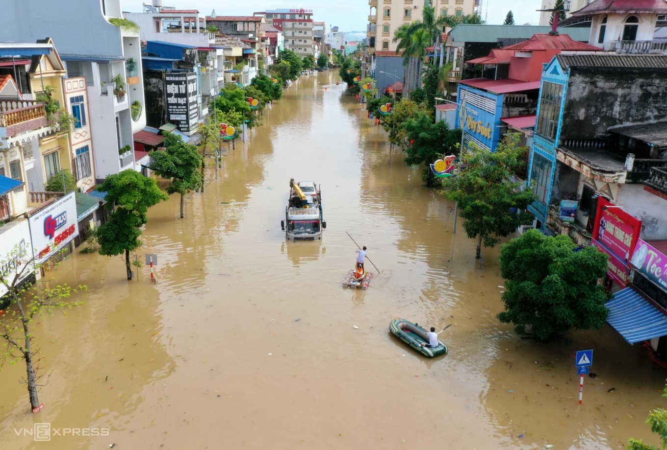
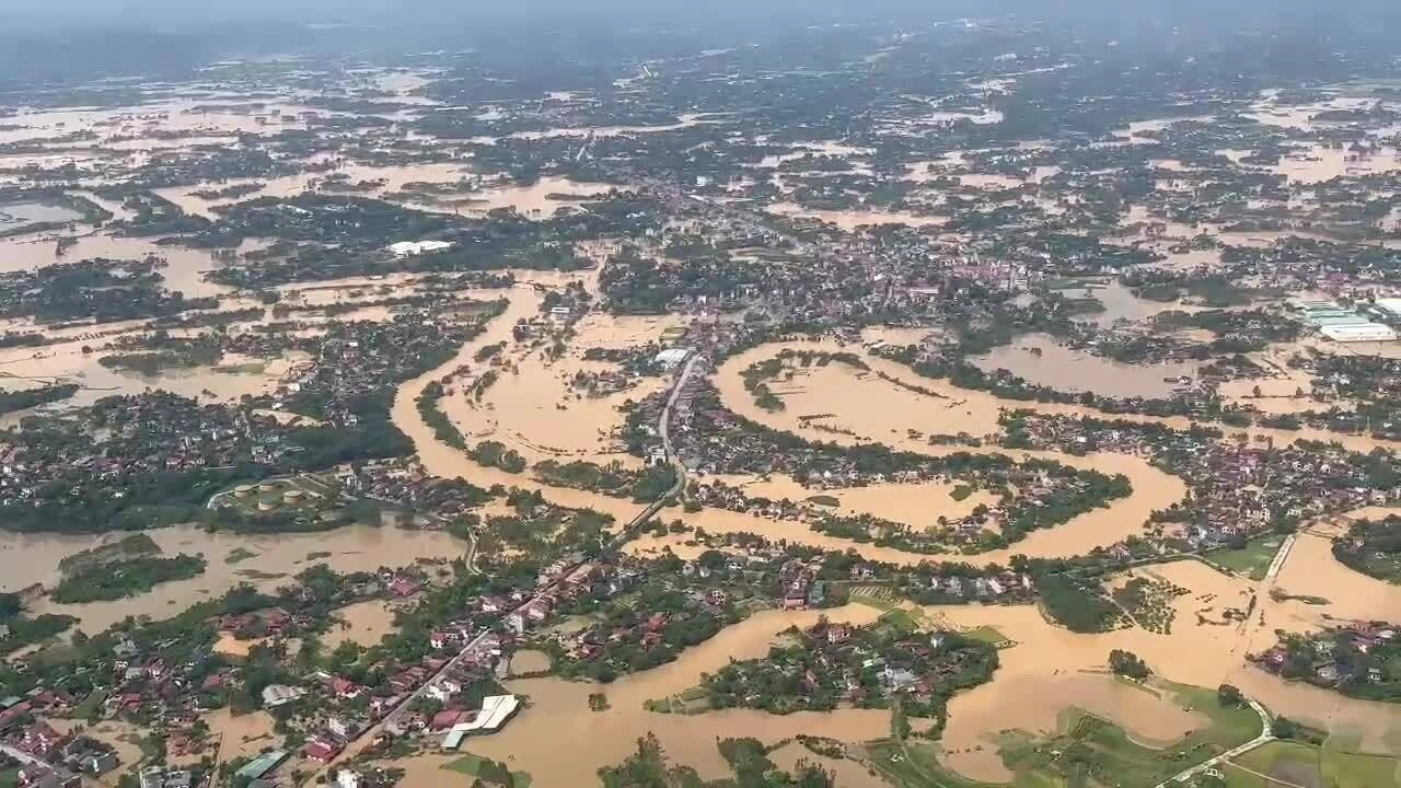
Northern flooding beats multiple records
In October, the remnants of Typhoon Matmo, which made landfall in China on Oct. 6, unleashed nearly a week of torrential rain, triggering historic flooding across northern Vietnam.
The provinces of Thai Nguyen, Cao Bang, Bac Ninh, and Lang Son bore the brunt of the devastation. Authorities assessed the disaster as extraordinarily destructive, with flood levels and damage surpassing numerous historical records.
Thai Nguyen bore the brunt of the catastrophe, emerging as the hardest-hit locality with floodwaters exceeding the historic peak of 2024’s Typhoon Yagi by 1.09 m, with the Cau River peaking at 29.9 meters on Oct. 8.
The deluge inundated over 200,000 homes in total, with many left 2-3 m under water.

Click để lật ảnh

Click để lật ảnh
Residents in Dan Tien Commune of Thai Nguyen Province take refuge on rooftops as floodwaters rise, on the afternoon of Oct. 7 as floodwaters continue to rush into the province’s center on Oct. 8, 2025. Photos by Hue Le, Duy Khac

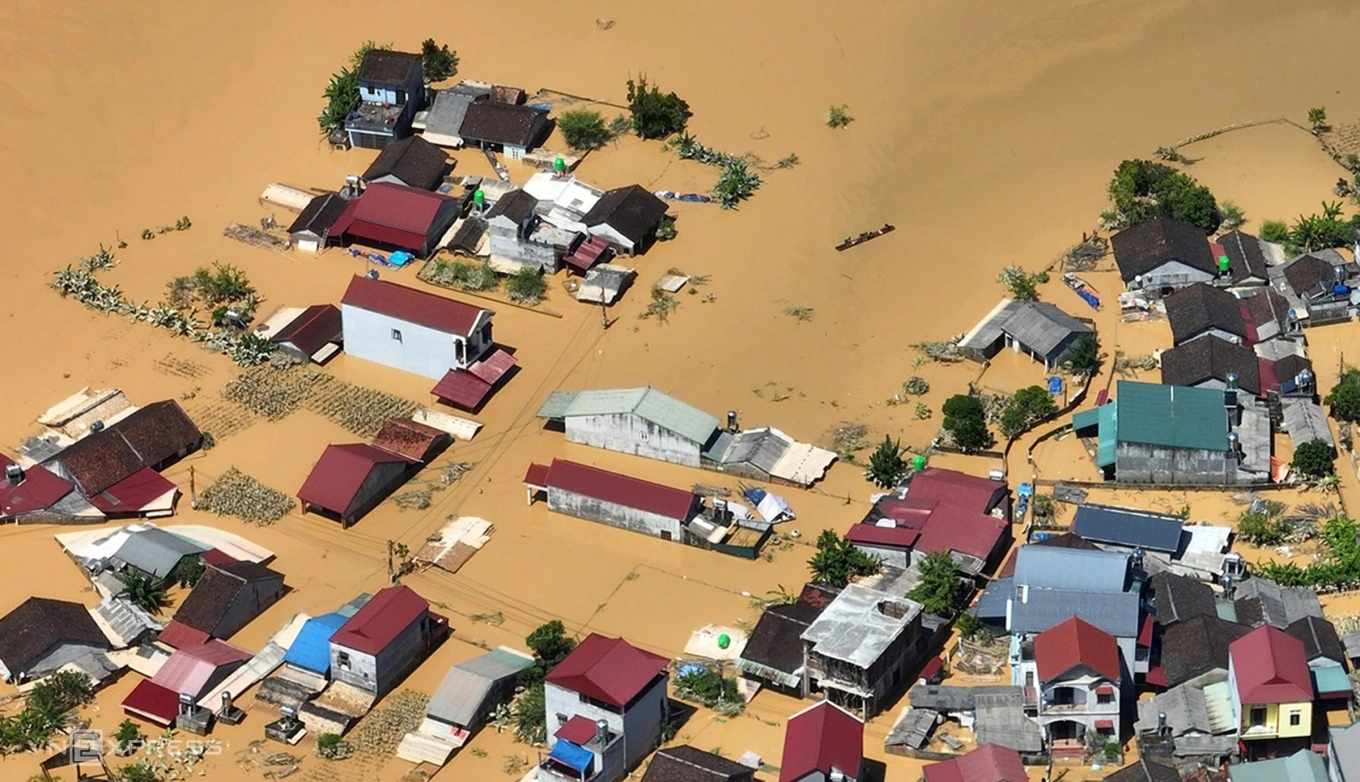
Also on Oct. 8, floodwaters on the Trung River in Lang Son Province that borders China reached 24.15 meters, 1.61 meters above the historic 1986 level. At its peak, more than 3,000 households across the province were reported to be flooded. Many homes were submerged by 30 cm to 2 m of water and were completely cut off for several days.
In Bac Ninh outside Hanoi, the flood peak on the Thuong River on Oct. 9 exceeded the record 1986 level of 7.52 meters by 0.08 – 0.18 meters. A total of 11,750 households were isolated and inundated by floodwaters.
A view of widespread flooding in Bac Ninh Province seen from above. Video by the Air Defense and Air Force Service
In Cao Bang at China border, the flood peak recorded at 11:00 p.m. on Oct. 7 on the Bang River reached 185.79 m.
This level was 3.29 m above the third-level warning threshold, the highest, and exceeded the historic flood peak of 1986 by 0.95 m. Across the province, nearly 7,500 households were flooded.
In total, historic flooding claimed 18 lives, with material losses estimated at VND17 trillion (US$646 million)
World’s second highest daily rainfall in central Vietnam
Central Vietnam faced an unprecedented meteorological crisis in late October, as historic rainfall shattered national records and submerged vast swathes of the region.
Between Oct. 22 and 29, provinces from Ha Tinh to Quang Ngai were battered by relentless downpours, with average widespread rainfall totals ranging from 450–900 mm in Thua Thien Hue and Ha Tinh, 300–600mm in Da Nang, and 200-450 mm in Quang Tri and Quang Ngai.
The most staggering figure emerged from the Bach Ma Peak in Thua Thien-Hue. In a single 24-hour window from 7:00 p.m. on Oct. 26, the station registered 1,739.6 mm of rain. This figure stands as the highest single-day rainfall ever recorded in Vietnam’s history, surpassing all previous benchmarks for extreme precipitation, and the second-largest daily total in the world, behind only a 1966 record in the Indian Ocean.

The sheer volume of water overwhelmed river systems, triggering exceptionally high floodwaters and landslides that isolated communities across Ha Tinh, Hue, Da Nang, Quang Tri, Quang Ngai and Lam Dong. The rapid rise in water levels severed transportation links and triggered dangerous landslides, posing immediate threats to lives and infrastructure in both urban and mountainous areas.
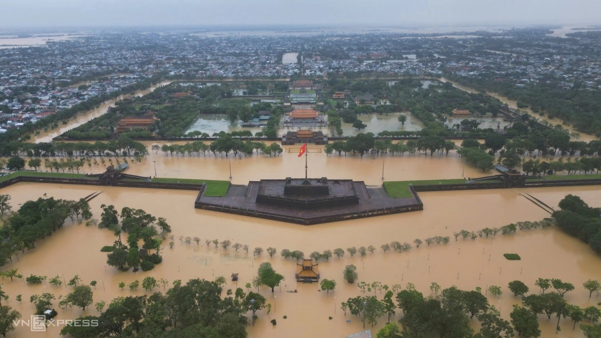
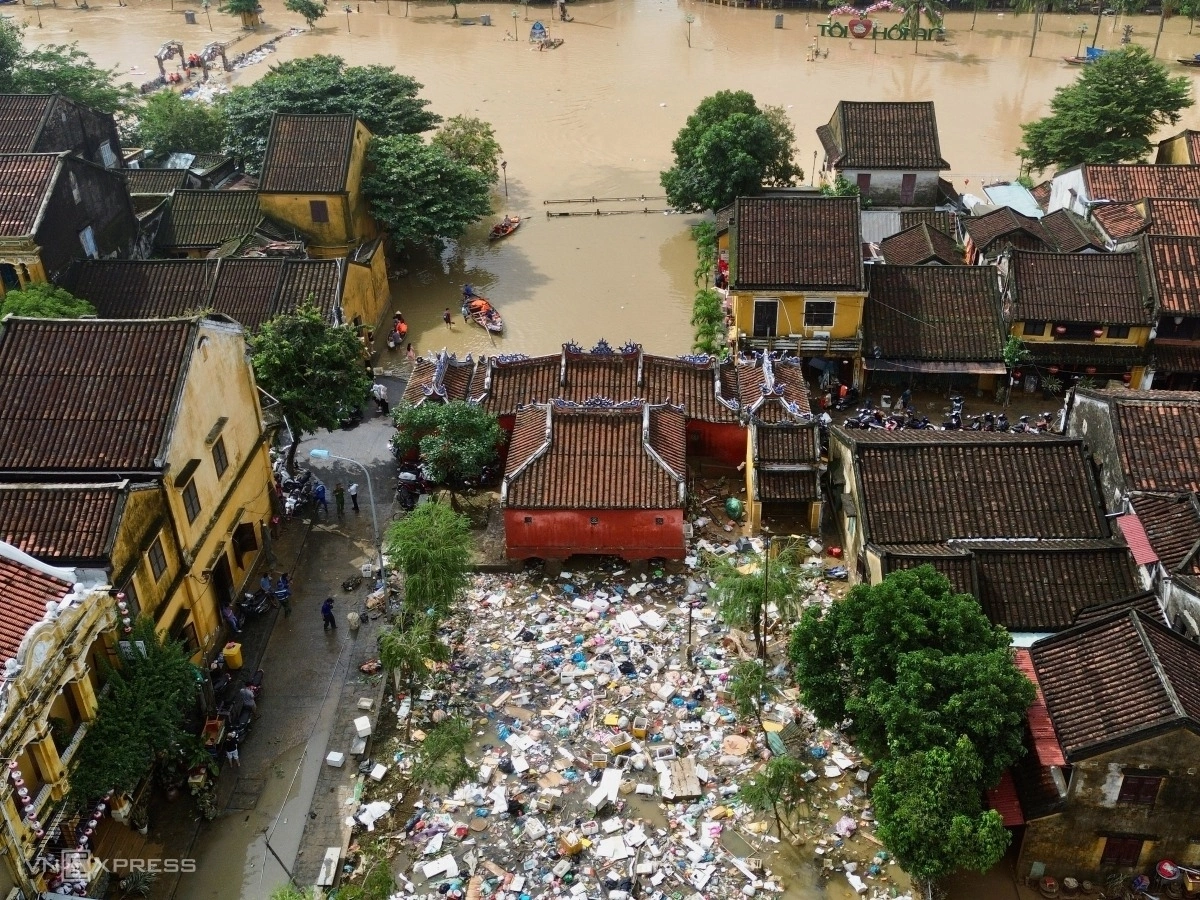
On Oct. 27, the Bo River in Hue crested at 5.31 meters, surpassing the record flood of 2020. Three days later, the Thu Bon River in Hoi An rose to 5.62 meters, exceeding the historic flood level of 1964 by 0.14 meters.
Click để lật ảnh
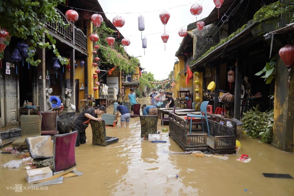
Click để lật ảnh
Floodwaters receded in Hoi An’s ancient town on Oct. 31, leaving thick mud and trash across houses and streets as residents rushed to clean up. Photos by Read/Nguyen Dong
As of Oct. 31, floods and landslide claiming the lives of 28 people. The fatalities were concentrated in the hardest-hit areas, with 12 deaths in Thua Thien Hue and 11 in Da Nang. Authorities also reported that six people remain missing and 43 others were injured during the disaster.
The destruction to property has been extensive. A total of 91 houses were reported collapsed or completely swept away by the raging waters, while another 181 homes suffered significant structural damage and over 133,000 were flooded.

Experts attribute the catastrophe to a complex synthesis of extreme weather patterns. The deluge was driven by the collision of intensified cold air masses from the north with the tropical convergence zone, further exacerbated by strong, moist easterly winds blowing in from the sea.
This “multi-hazard” interaction created a vertical column of instability that locked heavy rain bands over the central region for days, leading to the historic accumulation observed at Bach Ma.
South central Vietnam hit by worst flooding in 50 years
The south-central coast and Central Highlands, home to popular tourist cities Da Lat and Nha Trang, were battered by an extreme and unprecedented flooding event in November, with intensity and rainfall indicators shattering historical records dating back over half a century. The devastation peaked between Nov. 15 and 22, driven by torrential downpours that overwhelmed the region’s river systems.
One-week rainfall in many areas ranged widely from 400 to 900 mm. The most staggering figures were recorded at the Son Hoa station in Dak Lak Province, which registered 1,069 mm, and M’Drak, which received 805 mm. Consequently, river levels in Dak Lak and Lam Dong surged past historic peaks established during the major floods of 1993 and 2009. Similarly, the Dinh River at Ninh Hoa station in Khanh Hoa exceeded the record flood levels of 1986.
The human cost has been catastrophic. Dak Lak Province was hit hardest and its authorities confirmed the death toll at 113, as announced earlier this month. Khanh Hoa recorded 22 cases, Lam Dong five, Gia Lai three, Hue and Da Nang two each, and one in Quang Tri. Ten people were reported missing in Dak Lak (eight) and Da Nang (two).
The scale of destruction has also dealt a severe blow to the regional economy, with total losses estimated at over VND14.3 trillion by the end of the month.
At the height of the disaster, the scale of the inundation was staggering. More than 272,000 houses were submerged under water levels ranging from one to three meters. Dak Lak bore the brunt of the crisis with 150,000 flooded homes, while Khanh Hoa saw 100,000 properties underwater.
Staff reporters
Comments are closed.