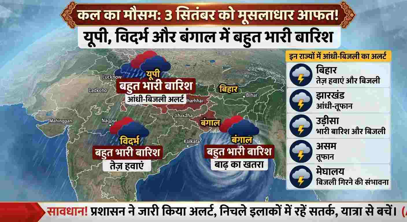
Monsoon has reached its most aggressive phase due to active monsoon cyclones and low-pressure areas across the country. According to the latest forecast of the Indian Meteorological Department (IMD), on September 3, many states of the country will see extremely heavy rainfall accompanied by torrential thunder. Especially in Uttar Pradesh, Vidarbha (Maharashtra) and West Bengal, the Meteorological Department has feared heavy waterlogging and a sharp rise in the water level of rivers. Apart from this, a serious alert has been issued in more than 15 states regarding strong thunderstorm, winds with speed of 40 to 50 kilometers per hour and lightning. Uttar Pradesh: Heavy to very heavy rainfall in Terai and Central districts Due to direct passage of monsoon trough in Uttar Pradesh, weather is going to be extremely aggressive over large parts of the state on September 3: Purvanchal and Terai belt: Orange to red alert has been issued for extremely heavy rainfall in Gorakhpur, Deoria, Basti, Sant Kabirnagar, Maharajganj, Balrampur, Shravasti and Bahraich. Central and Western UP: Lucknow, Kanpur, Unnao, Ayodhya, Bareilly, Moradabad and Meerut will be covered with dense dark clouds throughout the day and heavy showers are expected in several cycles. The Meteorological Department has warned farmers and common citizens to avoid standing in open fields, under trees and near unpaved constructions during rains, as the risk of being struck by lightning will be very high. Vidarbha and Central India: Waterlogging and flood-like conditions expected in many districts The situation has become quite sensitive due to the formation of a deep pressure system in the Vidarbha region of Maharashtra: Nagpur, Chandrapur, Gadchiroli, Amravati, Yavatmal and Wardha may receive exceptionally heavy rainfall of more than 200 mm on September 3. The local administration has been instructed to drain water from low-lying areas and keep relief teams ready. There is a possibility of torrential rains in Chhindwara, Seoni, Balaghat and Jabalpur divisions of Madhya Pradesh, which may cause spate in Narmada and its tributaries. West Bengal and Odisha: Impact of moist winds coming from the Bay of Bengal Due to the cyclonic circulation formed in the Bay of Bengal, the intensity of rain has increased significantly in Eastern India: West Bengal: There is an alert of continuous heavy rain in Kolkata, Howrah, Hooghly, South and North 24 Parganas, East and West Medinipur. There is a danger of landslides in Sub-Himalayan Bengal (Darjeeling, Kalimpong, Jalpaiguri). Odisha and Jharkhand: Yellow alert of moderate to heavy rain with thunder and lightning has been issued in many districts including Mayurbhanj, Balasore, Sundergarh and Ranchi, Jamshedpur, Dhanbad. Fishermen have been advised not to venture into the sea. Latest situation of Delhi-NCR, Bihar and hill states Delhi-NCR: There will be cloud cover in the capital Delhi, Noida, Ghaziabad and Gurugram on 3rd September. There is a possibility of light to moderate rain and strong winds at the speed of 35 to 45 km per hour, due to which the temperature will remain between 31 to 33 degrees. Bihar: There is a possibility of lightning along with strong thunder in Patna, Gaya, Bhagalpur, Purnia and Muzaffarpur. The Disaster Management Department has issued an alert especially in rural areas. Uttarakhand and Himachal Pradesh: Due to torrential rains in Dehradun, Nainital, Chamoli, Mandi and Kullu, warnings of rock fall and landslides have been issued on sensitive hilly roads. Travelers have been advised to avoid unnecessary hill travel.