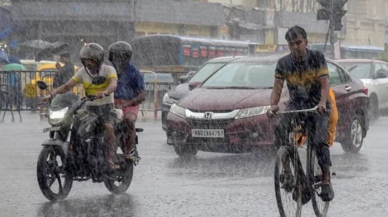
During the withdrawal of monsoon in the country, the sudden rapid change in atmospheric conditions has made the weather extremely aggressive. The Indian Meteorological Department (IMD) has issued a special weather bulletin for Sunday, September 6, 2026, warning of heavy to very heavy rainfall, severe thunderstorm and lightning in more than 13 major states of North, Central and Eastern India. Due to the collision of the low pressure area formed in the Bay of Bengal and the active cyclonic circulation over North-West India, unprecedented accumulation of dense monsoon clouds is being seen in the entire plains. According to meteorologists, during this period the wind speed in many areas can touch dangerous levels ranging from 50 to 80 kilometers per hour. The administration has appealed to the common citizens who are planning to travel or roam on the holiday on Sunday, the drivers passing through the highway and the farmers who are tending the crops in the fields, to take extra precautions. People suffering from the scorching heat for the past few days will get relief from this widespread weather change in the form of a drastic drop in temperature by 3 to 5 degrees, but along with it, there is also the danger of water logging in low-lying areas, collapse of old trees and mud houses and deadly risk of lightning. Torrential rain with thunder and lightning in Delhi-NCR, stormy winds will blow at a speed of 50 KM. September 6 is going to be a day of stormy cloud activity in the national capital Delhi and the entire NCR region around it. The Meteorological Department has issued an alert of moderate to heavy rain with thunderstorm for Delhi, Noida, Greater Noida, Ghaziabad, Gurugram and Faridabad. According to the Meteorological Centre, the maximum temperature in Delhi on Sunday is expected to be around 29 degrees Celsius and the minimum temperature will be around 24 degrees Celsius. The sky will be covered with dense dark clouds throughout the day and there is a possibility of strong gusty winds at a speed of 40 to 50 kilometers per hour between afternoon and evening. Due to this torrential rain, there may be a problem of heavy waterlogging at sensitive intersections like Minto Bridge, ITO, Ashram Chowk, Dhaula Kuan, Ring Road of Delhi and Hero Honda Chowk, Rajiv Chowk and IFFCO Chowk of Gurugram. Delhi and Haryana Traffic Police have advised drivers to avoid submerged underpasses and drive slowly by maintaining a safe distance. Due to strong winds, strict instructions have been given not to park vehicles under weak electrical wires and hoardings. The mood will deteriorate in the western and eastern parts of Uttar Pradesh: Warning from Lucknow, Noida to Gorakhpur. The range of monsoon clouds is going to be the widest and most intense in Uttar Pradesh on Sunday. Meteorological Center Lucknow has predicted heavy rainfall with strong thunderstorms in dozens of districts of Western, Central and Purvanchal of the state. Meerut, Muzaffarnagar, Saharanpur, Aligarh, Mathura, Agra, Bijnor, Badaun and Pilibhit of Western UP will see torrential rains along with loud thunder. There are strong chances of heavy rain in Lucknow, Kanpur, Unnao, Hardoi, Sitapur, Shahjahanpur, Rae Bareli, Amethi and Sultanpur of Central UP. In the capital Lucknow on Sunday, the maximum temperature will be around 31 degrees and the minimum will be around 26 degrees Celsius. Due to moist winds coming from the Bay of Bengal in Ayodhya, Gorakhpur, Deoria, Azamgarh, Basti and Varanasi belt of Purvanchal, there is a possibility of heavy rain and lightning at many places. The State Relief Commissioner's office has directed all district magistrates and municipal bodies to deploy additional pumping stations for drainage and maintain constant vigil along the banks of swollen rivers like Ganga, Ghaghra, Rapti and Saryu. Big danger of lightning in Bihar and Jharkhand: Instructions to be careful in Patna, Gaya and Ranchi. The weather trend in the major states of Eastern India, Bihar and Jharkhand, will remain very sensitive on September 6. The Meteorological Department has issued a serious warning (Yellow & Orange Alert) of heavy rain with thunder and lightning in more than 20 districts of Bihar. There will be heavy rainfall with strong winds in the capital Patna, Gaya, Jehanabad, Bhojpur, Rohtas, Buxar, Vaishali, Samastipur, Darbhanga, Madhubani, Saharsa, Supaul, Purnia, Araria, Kishanganj, Katihar, Bhagalpur and Munger. The maximum temperature in Patna on Sunday will be around 32 degrees Celsius and the minimum temperature will be around 27 degrees Celsius. Bihar State Disaster Management Authority has warned farmers and laborers working in open fields, especially in rural areas, to immediately take shelter in pucca houses as soon as thunder starts, because the risk of loss of life due to lightning is highest during this season. Neighboring state Jharkhand may also witness severe weather on 6th and 7th September. A warning has been issued in the capital Ranchi, Jamshedpur, Dhanbad, Bokaro, Deoghar, Ramgarh, Khunti, Palamu, Hazaribagh, Giridih and West Singhbhum of torrential rain with thunderstorms and stormy winds at a speed of 40 to 50 km per hour. The maximum temperature in Ranchi can drop to 29 degrees Celsius and the night temperature can reach 23 degrees. There is a possibility of sudden swelling of rivers and strong flow in drains in the plateau and forested areas of Chhotanagpur. Cyclonic winds alert in Madhya Pradesh and Rajasthan: Heavy rain in Bhopal, Indore and Jaipur. The active weather system will have a widespread impact in both the western and eastern parts of Madhya Pradesh. According to the Meteorological Department, there is an alert of heavy rain and stormy winds in Bhopal, Indore, Ujjain, Dewas, Dhar, Harda, Khandwa, Khargone, Hoshangabad (Narmadapuram), Raisen, Sagar, Damoh, Chhatarpur, Katni, Umaria, Shivpuri and Morena. In the capital Bhopal on Sunday, the maximum temperature may fall to 26 degrees and the minimum temperature may fall to 23 degrees Celsius, due to which a slight coolness will be felt even during the day. Due to rains in the catchment areas of Narmada and Betwa rivers, the water level of dams is being closely monitored and the gates of many dams are likely to be opened. On the other hand, monsoon clouds are ready to rain with full force in Marudhara Rajasthan also. In districts like Jaipur, Sikar, Jhunjhunu, Ajmer, Tonk, Sawai Madhopur, Bundi, Chittorgarh, Dholpur, Bharatpur, Churu and Bikaner, a warning has been given of a strong dust storm with a speed of 60 to 70 kilometers per hour followed by torrential rain. The maximum temperature in Jaipur is expected to be 32 degrees and minimum 24 degrees Celsius. There is a possibility of heavy rain with thunder at local level in some parts of Jaisalmer and Barmer in western Rajasthan. Landslide alert in hilly states and important agricultural advisory for farmers: On September 6, the weather may become quite severe in the hilly states of North India, Himachal Pradesh, Uttarakhand and Jammu and Kashmir. Kangra, Kullu, Mandi, Shimla, Chamba, Hamirpur and Bilaspur of Himachal Pradesh will experience heavy rain with winds of up to 50 km per hour. The maximum temperature in Manali can reach 14 degrees and the night temperature can drop to 6 degrees Celsius. Due to torrential rains in Dehradun, Nainital, Haridwar, Rishikesh, Chamoli and Tehri Garhwal of Uttarakhand, there is a serious danger of landslides and rockslides on sensitive hilly roads. The administration has advised the tourists going on Char Dham Yatra and mountain tour to completely avoid going to the banks of rivers unnecessarily or traveling on sensitive roads at night. In view of this changed weather pattern, agricultural experts have issued important guidelines for farmers. At present, crops of paddy, maize, millet, sugarcane and seasonal vegetables are standing in the fields. Strong storms and waterlogging increase the chances of crops falling and rotting. Farmers have been advised not to allow water to accumulate in the fields and to clean the drainage drains immediately. Also, do not spray any kind of chemical fertilizer or pesticide on the crops for the next two days. Instead of tying their cattle under open trees or tin sheds, cattle herders should keep them in safe permanent enclosures so that they can avoid any untoward incident due to lightning.