
On one hand, extreme conditions like floods and drought in different parts of the world, on the other hand, El Niño is gathering strength in the Pacific Ocean. The World Meteorological Organization (WMO) said the current El Niño situation could intensify in the coming months and its effects are likely to last until February 2027. This forecast is very important for a rain-fed agricultural country like India. Because there is often a relationship between weak seasonal winds, low rainfall and high temperatures with El Niño.
Why worry about El Niño for India?
When we hear the word 'El Niño' in the context of Indian weather, the first thing that comes to our mind is rain. This climatic change in the Pacific Ocean can affect the seasonal wind patterns of India. The figures of the current year also show a worrying picture. According to IMD information, the country received 16 percent less rainfall than normal in August. In the same year, August of this year has been cited as the hottest August in the country since 1901.
Fear of rain shortage in September
There is not much relief regarding the last phase of the rainy season. IMD said, the entire country may receive less rainfall than normal in the month of September. According to forecast, the rainfall amount in September is likely to be below 91 per cent of the long period average or LPA. The LPA of normal rainfall in September is around ১৬৭৭.৯ mm. As a result, if there is a shortage of rain in the last phase of the rainy season, it can have an impact on water resources and agriculture in different areas of the country.
 Not only rain, winter can also affect
It is not right to assume that the effect of El Niño will stop as soon as the rains end. Strong El Niño can also influence the dynamics of winter temperatures in India. There is already talk of reduced stability of winters and a trend of relatively higher temperatures in winter. In the research of 'Climate Trends', the issue of change in the winter character of North India has also come up.
Big risk to agriculture in February-March
राबी मर्शूम may be the place of biggest concern for farmers. February and March are especially important periods for wheat cultivation. During this time, the process of formation and transformation of wheat grains starts. If the temperature increases more than normal, 'Terminal Heat Stress' can be created on the wheat. As a result, there is a risk of crop damage.
How fast is the temperature rising?
The research of 'Climate Trends' has revealed a worrying trend of increasing temperature in North India.
February: increase of about 0.69 degrees Celsius per decade
March: approximately 0.58 °C increase per decade
April: increase of about 0.66 °C per decade
That is, the trend of winter ending quickly and summer coming ahead is becoming important for agriculture.
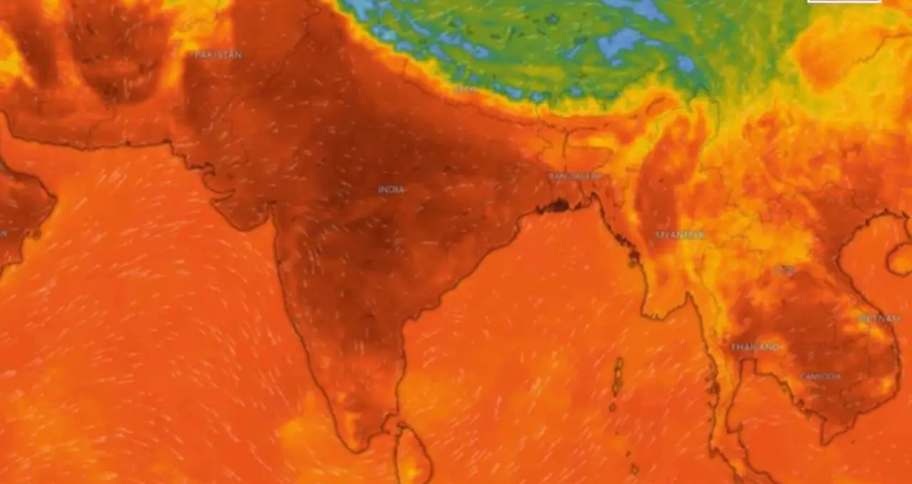 Temperature is affecting wheat production
The impact of temperature changes is already visible in important wheat producing areas of the country, the study noted. There is a risk of reduced productivity if the temperature increases during the critical period of wheat growth. If such hot conditions become more intense due to El Niño, then additional pressure may be created on the Rabi monsoon farmers.
Extreme weather may increase in different parts of the world
WMO's warning is important not only for India but for the world. If El Niño becomes strong, the normal balance of weather in different areas may be disrupted. At some places, there may be shortage and scarcity of rain, while at other places the possibility of excessive rainfall and floods may increase. At the same time, there may be a threat of prolonged abnormal heat flow in some areas. WMO World Health Organization warned that damage is already being caused by extreme weather such as drought and floods. The situation is likely to become more complicated if the intensity of El Niño increases.
What exactly is El Niño?
El Niño is not a storm. This is a major climatic change occurring between the Pacific Ocean and the atmosphere. This is a phase of ENSO or El Niño-Southern Oscillation. An El Niño situation is created when the sea surface temperature in the central and eastern Pacific Ocean increases compared to normal. Its effect is not limited to that area. It can also affect rainfall, temperature and weather patterns in different parts of the world. Its opposite phase is La Niña, and the state between these two is called the neutral phase.
 The formation of El Niño in the Pacific Ocean can bring major changes in the normal weather patterns around the world in the next few months. According to the World Meteorological Organization warning, the current El Niño may become stronger and have an impact till February 2027. In India, low rainfall, high temperatures and the risk of extreme weather are raising concerns for the agricultural sector.