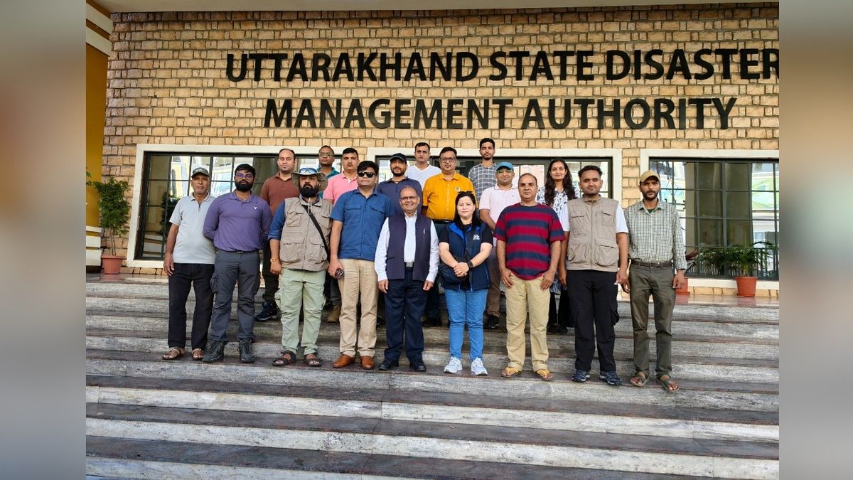
Uttarakhand News: It has always been a big challenge to predict when the mood of nature will change in the high Himalayan regions of Uttarakhand. Glacier lakes formed on mountains sometimes become the cause of huge destruction. Sensing this fear and danger in advance, the Uttarakhand government has taken a big step. A special team of scientists and experts has been sent on Tuesday to investigate two very important and sensitive ponds of the state, Saraswati Tal in Chamoli district and Kedar Tal in Uttarkashi district.
Secretary Disaster Management and Rehabilitation Vinod Kumar Suman from the office of Uttarakhand State Disaster Management Authority i.e. USDMA flagged off this team. This campaign is not just an ordinary tour, but with the help of modern science, it is an attempt to identify in time those dangers which may become a problem for the low-lying areas in the future. Chief Minister Pushkar Singh Dhami and Disaster Management Minister Madan Kaushik have extended their best wishes to the scientists embarking on this difficult and important journey.
Nature's big mathematics hidden at height
This entire mission has to be completed in those difficult roads and snowy valleys where even breathing becomes difficult for a common man. Saraswati Tal located in Chamoli district is at an altitude of about 5700 meters, while Kedartal of Uttarkashi is situated at an altitude of about 4750 meters. It has become very important to know the amount of water in the lakes located at such high altitudes, what their bottoms are like and whether their banks are weakening.
This team of scientists will go there and conduct bathymetry survey. In simple words, the team will prepare a map of the depth, spread of water and structure of the foothills of these lakes. This will make it clear that if the water suddenly increases due to cloud burst or glacier breaking, then how much pressure can the bank of the lake like a dam bear.
Timely warning is the best protection
Chief Minister Pushkar Singh Dhami has made it clear regarding this campaign that the main objective of the government is to ensure the safety of the people before any accident. When glacier lakes break in the mountains, the lower villages do not get time to recover. For this reason, the Chief Minister has emphasized that sensors, water level measuring machines and better communication equipment will be installed in the lakes.
If the lake water suddenly increases abnormally, such a system is being prepared so that sirens or messages can reach the low-lying areas immediately. Disaster Management Minister Madan Kaushik also said that after identifying sensitive areas, routes for safely evacuating people from there are being decided in advance. The relief and rescue infrastructure at the local level is being made so strong that immediate help can be provided in any emergency.
Government keeping an eye on 13 sensitive lakes
The Disaster Management Department in Uttarakhand has identified thirteen such glacier lakes across the state which may prove dangerous in future. It is a matter of relief that the scientific survey of four of these lakes has already been completed. Now the study of the remaining lakes is also being carried forward in a phased manner. In this series, Saraswati Tal and Kedar Tal have come.
According to Secretary Vinod Kumar Suman, this study will not be limited to lakes only, but it will also be seen what effect it can have on the villages and structures situated on the banks of rivers and drains originating from these lakes. On the basis of this scientific report, new security walls and drainage routes will be decided in the coming days.
The masters of legendary institutions are in the field.
To make this difficult campaign successful, many big scientific and technical institutions of the country have been brought together on one platform. This joint team includes USDMA, ULMMC, Birbal Sahni Institute of Archeology of Lucknow, Wadia Institute of Himalayan Geology, National Hydrology Institute of Roorkee, Nehru Mountaineering Institute as well as brave soldiers of NDRF and SDRF.
The team includes experts like Rohit Kumar, Nikhil Punia, Dr. Vishal, Deepak Bhatt, Dr. Sheikh Nawaz Ali, Shubhajit Ghosh, Prakash Ranjan Jena, Dr. Pinky Bisht, Swapnil Bisht, Shivayank Singh Negi, Shiv Shankar Yadav, Dr. Shivanand Mandraha, Nitesh Khetwal, Sandeep Singh, Sachin Kumar, Manish Kumar, Mahendra, Manoj Singh, Shardul Gusain and Narendra Singh Rawat. This entire team will together gather accurate information about these locks of the Himalayas from their experience of geology, water flow and mountaineering. On the occasion of farewell of the team, department advisor Vinay Ruhela, Lt. Colonel Raghuveer Singh Bhandari, DIG Rajkumar Negi and Dinesh Kumar Punetha were also present.
Also read: CM Dhami's initiative bore fruit, the process of making Uttarkashi-Tilwara road NH progressed.