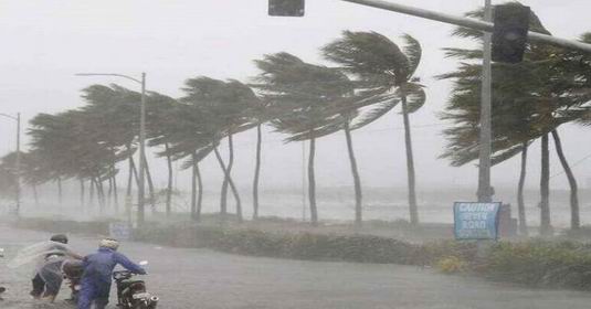
New Delhi. Weather patterns are going to change in many parts of the country. A low pressure area has formed in the south-eastern part of the Bay of Bengal on Friday morning. According to the India Meteorological Department (IMD), this system may become more active around November 14 while moving in the north-west direction. It is likely to turn into a depression by November 15. Due to its effect, rainfall activities may increase in Andaman-Nicobar Islands along with Tamil Nadu, Puducherry and some other areas of South India.
The Meteorological Department has not yet confirmed the formation of this system as a cyclone. At present it has been described as a low pressure area, whose further development is being monitored.
Chance of rain in Tamil Nadu and Puducherry
According to the forecast of the Meteorological Department, there may be rain at many places in Tamil Nadu, Puducherry and Karaikal on November 15. There is also a possibility of heavy rain in some areas. Heavy rainfall may occur in some parts of Tamil Nadu on November 16 also.
There is a possibility of widespread rain in Kerala and Mahe during 16 to 17 November. Coastal Andhra Pradesh, Yanam and Rayalaseema may receive light to moderate rain between November 14 and 17. Rain is expected at many places in Andaman and Nicobar Islands from 13 to 19 November. Heavy rain may also occur in some areas between 13 and 16 November.
Fishermen advised not to go into the sea
In view of the weather system forming in the Bay of Bengal, there is a possibility of strong winds in the maritime areas. The Meteorological Department has advised fishermen not to venture into the sea in the Andaman Sea till November 16. Fishing has been advised to be avoided in some parts of south-eastern Bay of Bengal from 13 to 16 November and in the adjoining central-eastern Bay of Bengal from 15 November.
In view of the possibility of bad weather in the sea and increase in wind speed, fishermen have been advised to follow the warning.
Chances of rain and snowfall in hilly states
The effect of western disturbance is being seen in the hilly areas of North India. There is a possibility of rain at many places in Jammu and Kashmir and Ladakh on November 13 and snowfall in higher altitude areas. Light to moderate rain may occur at some places in Himachal Pradesh and Uttarakhand also. There is also a possibility of thunder and lightning in some areas of Himachal.
Light rain may occur at some places in Punjab also. At the same time, there is a possibility of isolated rain and thundershowers in western Rajasthan on 14 and 15 November.
Weather will remain dry in Delhi-NCR and Uttar Pradesh
According to the forecast of the Meteorological Department, the weather is likely to remain dry in Delhi, Haryana, Chandigarh and eastern and western parts of Uttar Pradesh between November 13 and 19. That is, the system forming in the Bay of Bengal is not expected to have a direct impact in the form of rain in these areas at present.
Due to active weather systems in different parts of the country, rainfall activities may increase over South India and hilly states, while the plains of North India are expected to remain dry for the time being. The Meteorological Department has advised people, especially those involved in marine activities, to keep an eye on the latest warnings.