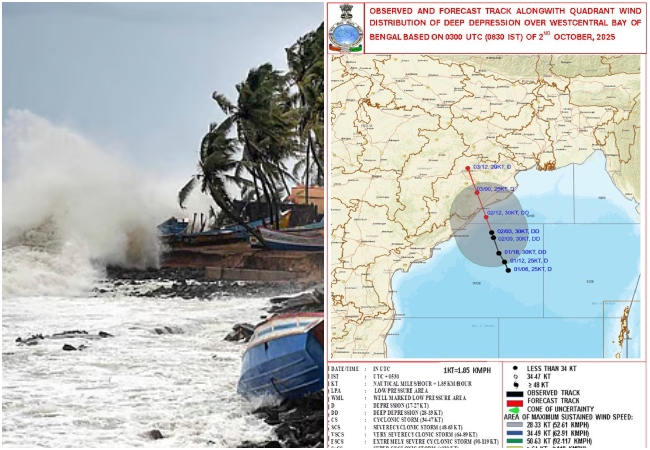
New Delhi. Andhra Pradesh and Odisha have not yet fully recovered from the impact of cyclones Arnab and Murasu that the threat of another cyclonic storm is looming in the Bay of Bengal. The low pressure area formed in south-east Bay of Bengal is strengthening rapidly. According to the Meteorological Department, this system may turn into a deep pressure in the next 24 hours and after that there is a possibility of taking the form of a cyclonic storm.
Read :- Cyclone Alert: Third cyclonic storm may hit in just a few hours, there will be torrential rains in these states
According to the latest bulletin of the India Meteorological Department (IMD), it is likely to turn into a cyclonic storm over the south and adjoining west-central Bay of Bengal by the evening of 16 November. During this period, storm winds can blow at a speed of 85-95 kilometers per hour, which can reach up to 105KMpH in gusts. This possible storm has been named 'Aqwan'. Iran suggested this name, which means 'bad-natured'.
Sound of trouble again in the Bay of Bengal
According to the Meteorological Department, the apparent low pressure area formed in the south-east Bay of Bengal at 8:30 am on November 14 remained at the same location. The cyclonic circulation associated with this extends to a height of about 7.6 kilometers above sea level. It is likely to move north-westwards and intensify into a deep depression during the next 24 hours.
After this this system can move in north-northwest direction. The Meteorological Department estimates that by the evening of 16 November, it may take the form of a cyclonic storm over the south and adjacent west-central Bay of Bengal. This means that the next two to three days are going to be very important in terms of the direction and strength of this system.
Read :- Cyclone Murasu: All 70 gates of Prakasam Barrage were opened, 71,000 cusecs of water released into Krishna River.
Where- how much will be the impact?
According to IMD, north-easterly winds are blowing in the lower troposphere of Andhra Pradesh and Yanam. However, as the system forming in the Bay of Bengal strengthens, weather conditions may change rapidly. In view of the possibility of high waves rising in the sea and the situation worsening, fishermen have been advised not to go into the sea.
Along with this, people living in coastal areas have also been asked to remain alert. At present, it will be necessary to keep an eye on the upcoming weather bulletin regarding the possible direction of the storm, its intensity and its impact on the coast.
Where will this storm hit?
It is feared that this cyclone Akwan may hit the coast between Machilipatnam and Visakhapatnam in Andhra Pradesh. However, at present no final confirmation has been made by the Meteorological Department regarding the place and time of its landfall. This estimate may also change with changes in the direction and intensity of the storm.
Read :- Cyclone Murasu: Alert of heavy rain in the next few hours in 15 states including UP, winds will blow at the speed of 70 KM.
If this system turns into a cyclonic storm and reaches close to the coastal areas, there may be a risk of strong winds and heavy rains. In such a situation, the administration and local people in the coastal districts will have to keep an eye on the official warnings of the Meteorological Department.