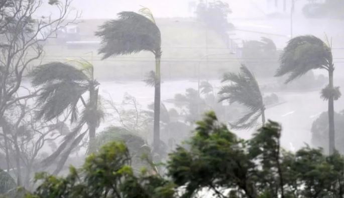
New Delhi. Another cyclonic storm is going to form in the Bay of Bengal, due to which warnings of torrential rain have been issued in many states. This will be the third cyclonic storm in the last few days. The Meteorological Department (IMD) on Saturday said that a low pressure area over the south-eastern Bay of Bengal will turn into a depression in the next 24 hours and is likely to turn into a cyclonic storm by the evening of November 16. In such a situation, people of many states need to be careful, because this storm can bring devastation. According to the Meteorological Department, there is an alert of heavy rain in the coastal areas of Odisha, Tamil Nadu, Andhra Pradesh.
Read :- Cyclone Akwan: Akwan storm rising from the Bay of Bengal, will wreak havoc in the next 24 hours, winds will blow at a speed of 105.
Daily Weather Discussion (14/11/2026)
The well marked low pressure area over south-eastern Bay of Bengal is very likely to move in north-westerly direction and intensify into a depression over the same area during the next 24 hours. Thereafter, it is likely to move north-northwestwards and further intensify into a Cyclonic Storm over southern and adjoining central parts of west-central Bay of Bengal by the evening of 16 November.
YouTube : https://t.co/X0GCDNrQbP
Facebook: https://t.co/AbhATqnJx9For more information, visit Us : https://t.co/BPpoTbykBF
Read:- Cyclone Alert: Be careful! Another cyclonic storm is coming, there will be heavy rain in these states including UP
#IMD #CycloneAlert #BayOfBengal #DepressionAlert #CyclonicStorm #WeatherUpdate #IMDAlert #WeatherForecast
@moesgoi @airnewsalerts @DDNational @ndmaindia @ICRER_MHA
— India Meteorological Department (@Indiametdept) November 14, 2026
“A clear low-pressure area has formed over south-eastern Bay of Bengal and is very likely to turn into a depression in the next 24 hours,” the IMD said in a post on Twitter. The post further read that it is likely to further intensify into a cyclonic storm over parts of the south and adjoining west-central Bay of Bengal around the evening of 16 November 2026. Fishermen and coastal communities are advised to avoid Follow IMD’s official weather updates and warnings.”
Read :- Cyclone Murasu: All 70 gates of Prakasam Barrage were opened, 71,000 cusecs of water released into Krishna River.
Director of the Meteorological Center in Bhubaneswar, Manorama Mohanty, said that the low pressure area formed in the south-east of the Bay of Bengal may move north-westwards and turn into a depression in the next 24 hours, after which it may further intensify into a cyclonic storm around November 16. She said that the cyclonic system is likely to impact Odisha after four days, while rain activity is also expected in many districts of the state.
Cyclone Alert | Bay of Bengal
A Well Marked Low Pressure Area has formed over the Southeast Bay of Bengal and is very likely to intensify into a Depression during the next 24 hours.
It is further likely to intensify into a Cyclonic Storm around the evening of 16th November 2026 over the central parts of the South and adjoining Westcentral Bay of Bengal.
⚠️ Fishermen and coastal communities are advised to follow official IMD weather updates and warnings.
Stay alert, stay safe!
Read :- Cyclone Murasu: Alert of heavy rain in the next few hours in 15 states including UP, winds will blow at the speed of 70 KM.
#IMD #CycloneAlert #BayOfBengal #DepressionAlert #CyclonicStorm #WeatherUpdate #IMDAlert #WeatherForecast
@moesgoi @airnewsalerts @DDNational @ndmaindia @ICRER_MHA
— India Meteorological Department (@Indiametdept) November 14, 2026
According to Mohanty, there may be light rain in coastal areas of Odisha between November 14 and 18, while isolated rain is expected in Mayurbhanj, Keonjhar, Angul, Dhenkanal, Boudh, Raigarh, Kandhamal, Koraput and Malkangiri districts. Along with rain, there is a possibility of thunderstorm, lightning and strong winds at the speed of 40-50 kilometers per hour at some places. He further said that there is a possibility of isolated heavy rain in Ganjam, Gajapati, Puri and Khordha districts on November 18.
A depression is likely to form in the Bay of Bengal in the next 24 hours, and is likely to become a cyclonic storm by November 16.
#CycloneAlert #DepressionAlert #BayOfBengal #CyclonicStorm #WeatherUpdate #IMD #IMDAlert #WeatherUpdate #Cyclone #CycloneAlert #BayofBengal #WeatherAlert #WeatherForecast #CycloneUpdate
Read :- Cyclone Murasu: Now fear of cyclonic storm 'Murasu'! Andhra Pradesh will hit the coast on November 3, heavy rain in these states
@moesgoi @airnewsalerts @DDNational @ndmaindia @ICRER_MHA
— India Meteorological Department (@Indiametdept) November 14, 2026
There may be light rain in Delhi also
IMD scientist Naresh Kumar said that currently a Western Disturbance is persisting over North Pakistan and surrounding areas, due to which there is a possibility of rain and snowfall in parts of North-West India. Speaking to news agency ANI, Kumar said that right now there is a Western Disturbance in North Pakistan and surrounding areas. Due to its effect, there may be light to moderate rain and snowfall in the Western Himalayan region today and tomorrow. Light rain may also occur in the plains of Punjab, Haryana and Rajasthan. There may be very light rain in the National Capital Region including Delhi tomorrow. After the departure of this system, the temperature is expected to fall in entire Northwest India including Delhi-NCR from November 16. Right now, the temperature is slightly above normal, but we expect it to drop by 3 to 5 degrees Celsius across the area.