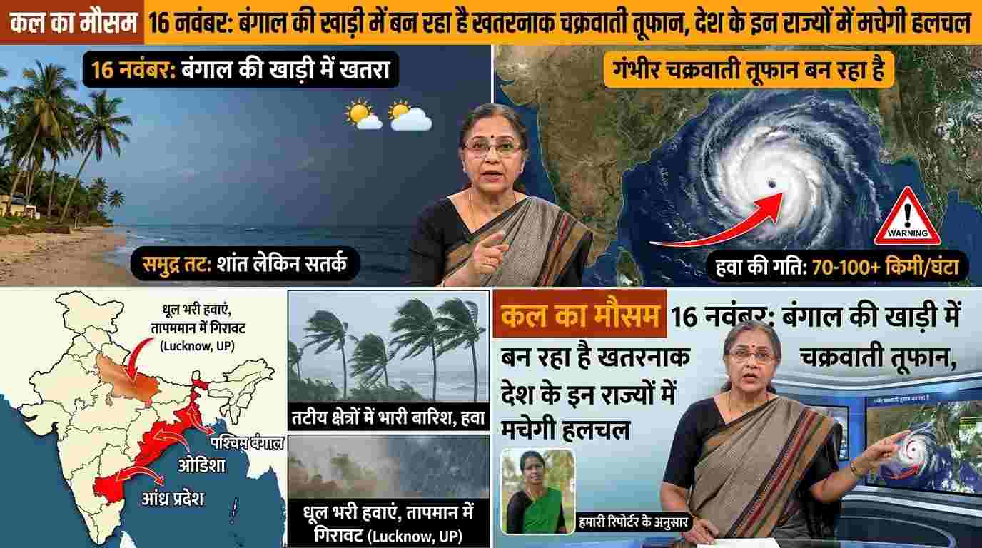
The weather patterns across the country are once again going to change rapidly. On one hand, dense fog has knocked in the plains of North India in the morning and night, on the other hand, a powerful weather system is developing in the Bay of Bengal which can take the form of a dangerous cyclonic storm on Monday, 16 November 2026. According to the latest bulletin of the Indian Meteorological Department (IMD), the deep depression over the south-eastern and adjacent south-western Bay of Bengal is continuously moving towards the north-west. Meteorologists have a clear assessment that from the morning of 16th November, the wind speed in the sea areas will become very aggressive and by the afternoon, this system will completely transform into a cyclonic storm. Due to its impact, a serious warning has been issued in the coastal states and island groups of torrential rains along with strong winds at a speed of 75 to 85 kilometers per hour. Stormy winds will blow at a speed of 75 to 85 kilometers per hour, alert of high waves in the sea. According to the official warning issued by the Meteorological Department, on November 16, the wind speed in the south-eastern and south-western parts of the Bay of Bengal will be 55 to 65 kilometers per hour in the morning, which will increase by afternoon to 65 to 75 kilometers per hour and can reach up to 85 kilometers per hour with gusts. By evening, the intensity of this storm will increase further in the central Bay of Bengal, where the wind speed is expected to be recorded between 90 to 120 kilometers per hour. In view of the high waves in the sea and extremely bad weather conditions, the Meteorological Department has given strict instructions to fishermen not to venture into the deep sea areas of Andaman Sea and Bay of Bengal from 16 to 20 November. The boats which are already in the sea have been instructed to immediately return to safe shores. Warning of heavy rain in these 9 states from Andaman-Nicobar to South and North-East. Due to the direct effect of cyclonic circulation, rain activities will be seen in about 9 states and union territories of the country on Monday, November 16. Its first and widespread impact will be seen in Andaman and Nicobar Islands, where heavy rains accompanied by thunderstorms and strong gusty winds at a speed of 40 to 60 kilometers per hour are expected. Apart from this, light to moderate rain will begin in Tamil Nadu, Puducherry, Karaikal, Kerala, Mahe and Coastal Andhra Pradesh of South Peninsular India. Talking about Eastern and North-Eastern India, there is a strong possibility of cloudy sky and scattered to moderate rainfall in many parts of Sub-Himalayan West Bengal, Sikkim, Arunachal Pradesh, Assam and Meghalaya on Monday. The Meteorological Department has also clarified that this storm will strengthen further and become a severe cyclonic storm on November 17, after which there will be a threat of extremely heavy rain in the coastal districts of Odisha and Andhra Pradesh on November 18 and 19. How will the weather be in Uttar Pradesh and Delhi-NCR on November 16, dense fog alert issued? While on one hand southern and coastal India is in shock due to the cyclone, on the other hand a completely different color of weather is being seen in the plain states of North India. There is no possibility of rain in Uttar Pradesh on November 16, but dense to very dense fog in the morning and night will increase the problems of the people. The Meteorological Department has issued a warning of dense fog for many districts of Uttar Pradesh from 15 to 17 November. Especially in Bareilly, Ayodhya, Kushinagar, Azamgarh and surrounding Terai and plains, visibility may drop to less than 200 meters in the morning, due to which road traffic and rail operations on national highways are likely to be affected. At the same time, the effect of Western Disturbance, which was active recently in Delhi-NCR, Haryana, Punjab and Rajasthan, has started reducing. The sky will be mainly clear in the capital Delhi and surrounding areas on November 16, although there may be a layer of light mist and smog in the morning, due to which a slight drop in the minimum temperature will be recorded. Snowfall in the hilly states will increase the chill in the plains, the administration has tightened its belts. After the recent rain and snowfall in the high altitude hilly areas of Jammu-Kashmir, Ladakh, Himachal Pradesh and Uttarakhand, now the north-western cold winds are moving towards the plains. Due to this, increase in coolness in the morning and evening is also being felt in Bihar, Jharkhand, Madhya Pradesh and Chhattisgarh. On the other hand, the state governments of Odisha, Andhra Pradesh and Tamil Nadu have put disaster management teams on alert mode to deal with the possible cyclonic storm. District Magistrates of coastal districts have been instructed to keep vigil in low-lying areas and ensure preparedness of relief camps to deal with any emergency. Local citizens and farmers have been advised to keep a constant eye on the official bulletins of the Meteorological Department and remain in safe places during inclement weather.