
Cold wave returns as rain and snow loom; IMD forecasts major drop in temperatures | India News
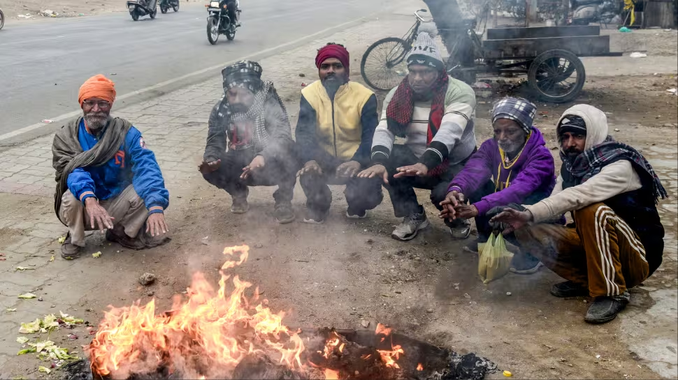
A fresh cold wave is set to sweep across large parts of north India as a cold and dry air mass descends into the plains, bringing biting northwesterly winds and a sharp drop in temperatures. Cold winds blowing at speeds of 15 to 35 kmph are expected to intensify the chill, particularly at night.
According to weather forecast data cited by an independent weather observer, minimum temperatures are likely to fall by 0 to 5 degrees Celsius across most parts of Punjab, Haryana, Chandigarh, Delhi-NCR, and northwest Rajasthan between January 24 and January 26. The update, shared on social media, is based on forecasts issued by the India Meteorological Department (IMD).
Despite clear and sunny conditions during the day, maximum temperatures are expected to remain suppressed, hovering between 13 and 17 degrees Celsius across the region during this period.
Add Zee News as a Preferred Source
The IMD said precipitation over the western Himalayan region is likely to taper off, with rainfall and snowfall activity reducing to isolated or scattered light to moderate levels on January 24 and 25.
However, a fresh western disturbance is expected to impact northwest India from January 27. This system is likely to trigger widespread rainfall and snowfall across the western Himalayan region on January 27, followed by scattered precipitation on January 28, the IMD noted in its daily bulletin.
The weather office has warned of isolated heavy rainfall and snowfall over Jammu and Kashmir and Himachal Pradesh on January 27. Light to moderate rain is also expected over the adjoining northwest plains during the same period.
On temperatures, the IMD said minimum temperatures are likely to drop by 3 to 5 degrees Celsius across northwest India over the next 24 hours. Dense to very dense fog is forecast in isolated pockets of Punjab, Haryana, and Chandigarh between January 24 and 26, while dense fog may also affect parts of Himachal Pradesh, Rajasthan, and Madhya Pradesh during this period.
Cold wave conditions are likely to prevail in isolated areas of Himachal Pradesh on January 25 and 26, the IMD added.
In its analysis, the IMD attributed the current weather pattern to a well-marked low-pressure area over north Pakistan, supported by strong upper-air winds and an active subtropical westerly jet stream. The department also said another western disturbance is expected to influence northwest India from January 26, potentially bringing further rain, snowfall, and a renewed spell of colder conditions.
Comments are closed.