
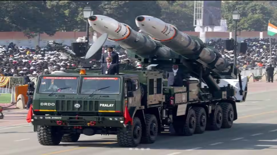
Deadly Precision, Total Target Kill Capability – Inside DRDO’s Pralay Missile System | India News
New Delhi: In a step toward full technological self-reliance in high-impact strike weapons, India has begun integrating its indigenous Geographic Information System (INDIGIS) into the Pralay tactical quasi-ballistic missile system. It means the Pralay missile will no longer rely on foreign software, not only for hardware and guidance, but also for digital mission planning.
INDIGIS was originally developed by the Defense Research and Development Organization’s Center for Artificial Intelligence and Robotics (CAIR). Its induction means that every layer of Pralay’s operational planning (from targeting to launch coordination) will now rest entirely on Indian technology.
Defense officials see this as a critical milestone in India’s push for strategic autonomy.
Add Zee News as a Preferred Source
Battlefield Data, Mapped With Precision
The most immediate benefit of this integration lies in how missile units plan and execute operations. Missile battery commanders will now operate on a secure, rugged and completely offline digital mapping platform.
The system allows them to clearly view launcher positions, missile variants, target folders, range rings and other mission-critical battlefield data in one unified interface.
Since the platform does not rely on foreign software or live satellite links, risks linked to data leaks, hidden backdoors or service disruption during conflict are effectively removed.
All planning, analysis and execution can continue even in electronic warfare conditions.
Built For First-Strike Missions
Until recently, many Indian military systems depended on GIS engines licensed from overseas firms. For a missile like Pralay, which is designed to strike high-value enemy targets at the very start of a conflict, this dependency was seen as unacceptable. The armed forces and the DRDO therefore pushed for a fully indigenous alternative.
After extensive testing, the DRDO transferred the technology to MicroGenesis TechSoft Pvt Ltd, a Bengaluru-based firm, which customized INDIGIS specifically for Pralay. The result is a complete desktop GIS environment, which allows units to prepare standardized maps and study combat zones with speed and accuracy.
A Missile Built For Speed And Survival
Pralay has a strike range of 150 to 500 kilometers and follows a quasi-ballistic flight path. It allows it to change course mid-air and evade interception. It is launched from mobile platforms that constantly change location, following a “shoot-and-scoot” doctrine.
To support such operations, commanders need instant visibility of launcher positions, range calculations for different warheads, terrain masking options to avoid enemy surveillance, post-launch escape routes and overlays of hostile radar and artillery zones.
INDIGIS delivers all of this in a system that remains reliable even if satellite links are jammed or disabled.
A Rare Strategic Achievement
With INDIGIS now embedded into Pralay, India has achieved a rare strategic trifecta by fielding a fully indigenous quasi-ballistic missile supported by entirely home-grown guidance and seeker systems, along with a domestically built GIS-based digital mission-planning framework.
Together, these elements send a signal that India’s missile forces are no longer just powerful, but also technologically sovereign.
Comments are closed.