
Heavy snowfall in the mountains, white blanket spread in Jammu-Kashmir and Ladakh, life affected
New Delhi. Due to the powerful Western Disturbance active in North India, heavy snowfall is continuing in the upper areas of Jammu and Kashmir and Ladakh and rain is continuing in the plains. This seasonal change has increased the cold in the valley and has also brought traffic to a standstill on many high passes.
Read:- Pre-Monsoon 2026: Powerful Western Disturbance will be active again, effect of pre-monsoon clouds will also be visible.
Snow hits tourist places
In the last 24 hours, 4 to 6 inches of fresh snowfall has been recorded in Kashmir’s famous tourist centers Gulmarg, Sonmarg, Pahalgam and Gurez. There is a huge crowd of tourists in Gulmarg, but the severe cold has also increased the problems of the people.
Severe cold in Ladakh
Temperatures have dropped below zero in Dras and Meenamarg sectors and light snowfall continues in Leh city, while upper parts of Nubra Valley remain cut off from the rest of the world. According to the Meteorological Department (IMD), this ‘wet spell’ will continue for the next 48 hours and another intense western disturbance will hit on March 28, due to which there is a high possibility of heavy snowfall in the mountains and heavy rain in the plains.
Read :- U-turn of weather in UP, there will be rain in these districts from Tuesday, strong winds will blow.
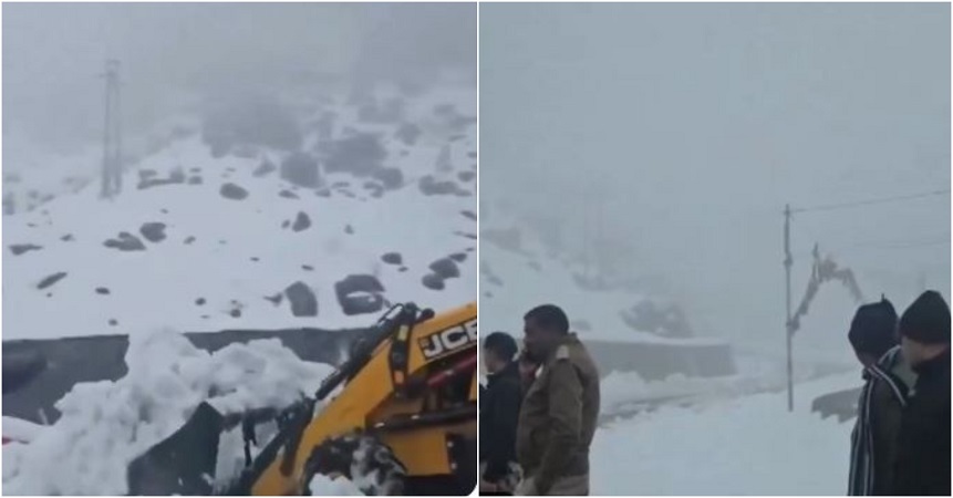
strategic route closed
Due to heavy snowfall, Zojila Pass and Razdan Top have been closed to avoid any kind of danger. The administration has advised not to travel on these roads due to slippery conditions and poor visibility. Gardeners and farmers of North Kashmir have been advised to stop spraying for the next few days and make proper arrangements for drainage in apple orchards.
If we talk about the current temperature situation, there is rain in Srinagar with 5.2°C, heavy snowfall in Gulmarg with 2.4°C and light snowfall in Leh with 1.8°C.
Report: Sushil Kumar Sah
Comments are closed.