
A rapidly intensifying severe weather system has triggered a tornado emergency in parts of North Central Illinois, especially around Washburn and nearby towns in Marshall County. Live warning bulletins from the National Weather Service indicate a confirmed, large and extremely dangerous tornado on the ground, moving northeast through populated rural areas. This type of warning applies when there is high confidence that ongoing life-threatening damage is occurring. Emergency alerts describe the situation as ‘particularly dangerous’, and officials warn that mobile homes and weaker structures could be destroyed if they are directly impacted.
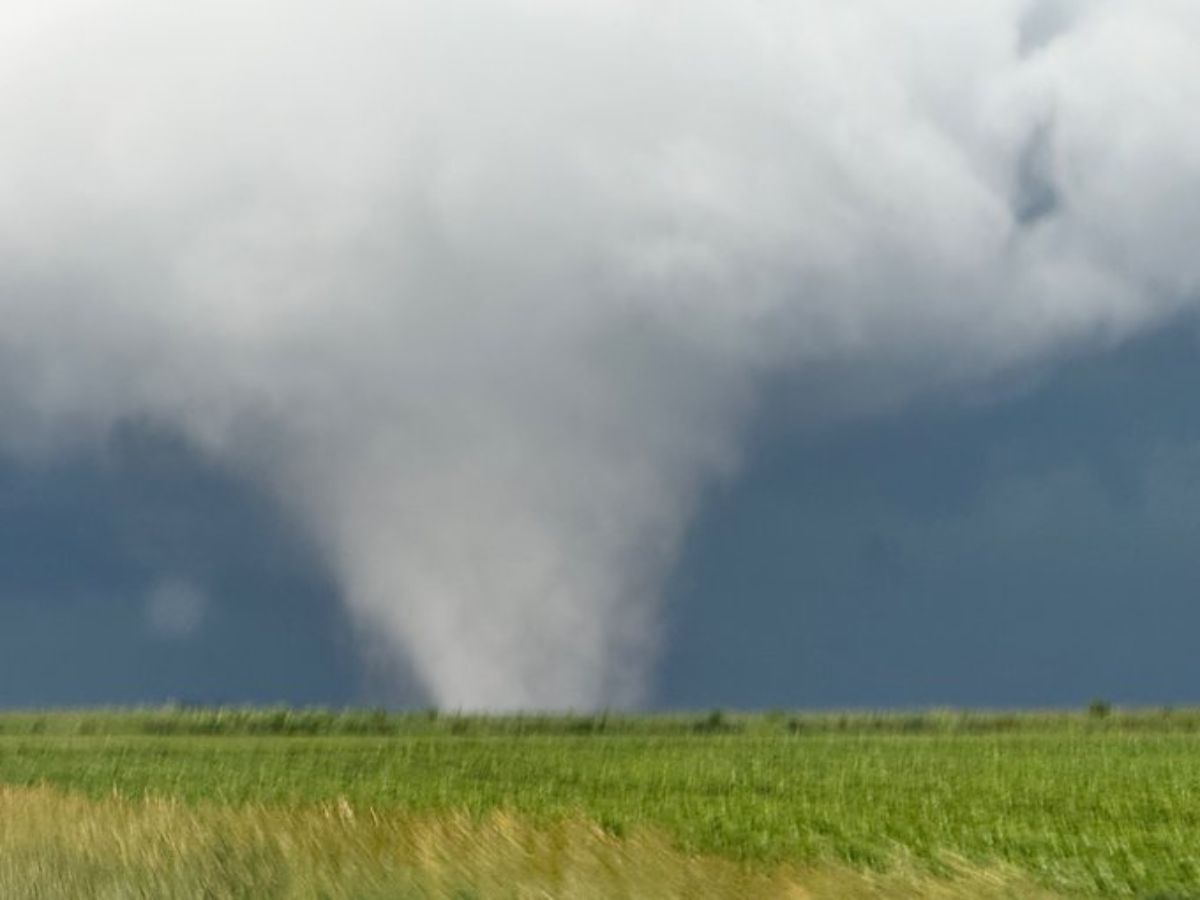
Sorry for radio silence, nonstop, filming tornadoes with my jaw on the floor in North Central Illinois. pic.twitter.com/etfynt039l
— Andrew Pritchard (@skydrama) June 11, 2026
Multiple Tornadoes Across West Central Illinois
Alongside the main tornadic cell, multiple sources indicate additional tornado activity across West Central Illinois, suggesting the event is part of a broader outbreak rather than a single isolated storm. Storm observers and live radar reports describe the following:
- A well-defined supercell structure with strong rotation
- Debris signatures visible on radar at times
- Rapid storm development along a northeast-moving track
- Multiple reports of ground-contact tornadoes in nearby counties
Social media storm trackers and live feeds from storm chasers also describe fast-evolving conditions, with at least one tornado reported to have a clear ‘cone’ or wedge-like structure, which is typically associated with stronger tornadoes.
🚨🇺🇸#BREAKING | NEWS ⚠️
From -The National Weather Service
There have been multiple tornadoes that have touchdown in the Illinois area power outages and storm damage expected this is a video near Marshall County Illinois.If you were near any of these counties, please seek… pic.twitter.com/ckaZbiCTa4
— Todd Paron🇺🇸🇬🇷🎧👽 (@tparon) June 11, 2026
Why This Storm System Is So Dangerous
Meteorologists highlight several factors making today’s setup particularly volatile across Illinois:
- Strong wind shear supporting rotating supercells
- High atmospheric instability fueling rapid storm growth
- Moisture-rich air feeding storm intensity
- A fast-moving storm line increasing the risk of sudden impact
This combination often leads to short-warning, high-impact tornadoes, especially in rural Illinois, where storms can intensify quickly with little visual warning.
Damage Risk And Threat Level
Based on current warnings and radar interpretation, the situation includes risks of:
- Significant structural damage in direct paths
- Downed trees and power lines
- Impassable rural roads due to debris
- Rapid escalation from funnel cloud to full tornado in minutes
Authorities are stressing that people in the warning zone should already be in safe shelter, preferably underground or in an interior room on the lowest floor.
ALSO READ: Ariana Grande Criticizes Trump White House Over Song Use In Immigration Video, Calls It ‘Heinous Nonsense’
Harshita is a journalist and digital content writer specializing in breaking news, current affairs, travel, education, and trending stories. She is focused on delivering accurate, timely, and engaging content with a strong emphasis on clarity and audience relevance.
The post Illinois Weather Alert: Large Wedge Tornado On Ground Near Washburn | Watch appeared first on NewsX.
Comments are closed.