
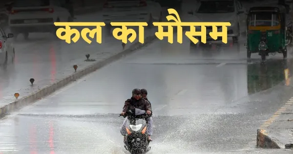
Kal Ka Mausam: After severe cold, now rain has started increasing problems in many parts of the country. According to the Meteorological Department, an alert of rain and storm has been issued in five states on February 19. During this period, there is also a possibility of lightning along with thunder. The wind speed can range from 40 to 45 kilometers per hour. Due to rain the temperature may drop by 2 to 3 degrees Celsius.
The minimum temperature is expected to drop by 2 to 4 degrees Celsius in northwest India in the next 48 hours. After this, there will be no major change in the temperature for five days.
Rain warning in these 5 states
According to the Meteorological Department, there is a possibility of rain in Uttarakhand, Himachal Pradesh, Tamil Nadu, Kerala and Andaman and Nicobar Islands on February 19. Andaman and Nicobar may receive scattered rain with strong winds at the speed of 30-40 km/hr. Fishermen have been advised not to go near the beach.
Delhi weather
There is a possibility of light rain in Delhi on 19 February. The maximum temperature is expected to be 26°C and minimum 13°C. The temperature may increase by 2-3 degrees from February 20.
Uttar Pradesh
Light rain may occur in Meerut, Gautam Buddha Nagar, Bulandshahr, Ghaziabad, Hapur, Baghpat, Shamli and Muzaffarnagar of Uttar Pradesh. The maximum temperature in Lucknow is likely to be 28°C and minimum 15°C.
Bihar
The weather will be clear in Bihar, although there will be slight cold in the morning and evening. There will be effect of cold in Purnia, Katihar, Araria, Sitamarhi, Darbhanga and Madhubani. Patna is expected to have a maximum of 28°C and a minimum of 16°C, while Gaya is expected to have a maximum of 28°C and a minimum of 15°C.
Uttarakhand and Himachal
There is a possibility of rain in Dehradun, Nainital, Uttarkashi, Rudraprayag and Haridwar. The maximum in Dehradun will be 21°C and the minimum will be 10°C.
There may be light rain/snowfall in higher reaches of Himachal Pradesh including Shimla, Solan, Kullu, Sirmaur, Una and Lahaul-Spiti. The maximum in Shimla will be 17°C and the minimum will be 7°C.
Jammu and Kashmir
Weather will remain clear in Jammu and Kashmir, but snowfall is possible in higher altitude areas like Sonamarg and Gulmarg. The maximum in Srinagar will be 12°C and the minimum will be 1°C.
Rajasthan
There is no possibility of rain in Rajasthan, although Jaipur and surrounding areas will remain cloudy. The maximum in Jaipur will be 24°C and the minimum will be 13°C.
Madhya Pradesh
There is a possibility of rain in 23 districts of Madhya Pradesh. Bhopal is expected to have a maximum of 28°C and a minimum of 17°C.
Maharashtra and Gujarat
The minimum temperature in Maharashtra may increase by 2-3°C in the next 5 days. The temperature in Gujarat is also likely to increase by 2-3°C in the next 3 days.
Comments are closed.