
MapmyIndia, a homegrown digital navigation and mapping platform known globally as Mappls, has introduced a new feature on its app that aims to let users plan their commute more easily using India’s public transport systems.
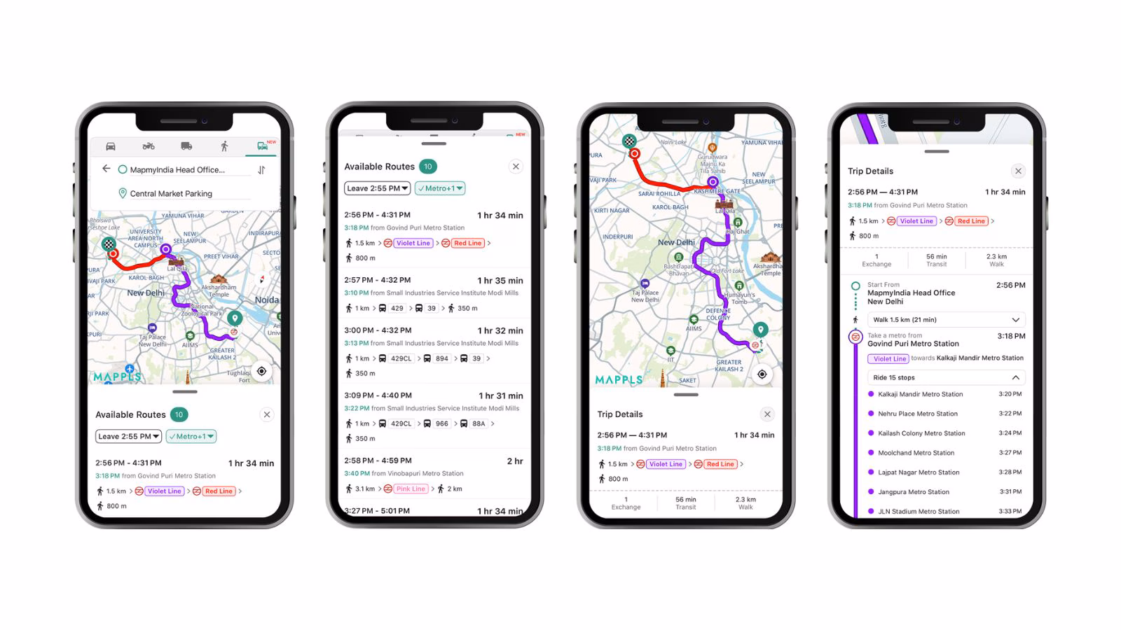
Mappls app users will now be able to view metro, rail, and bus transport routes, directly on the app, along with information such as stations, stops, and interchange options, the Delhi-based company said in a press release on Tuesday, December 30.
These options are designed to help users plan more efficient and sustainable journeys on Indian public transport via the Mappls app, which currently has more than 40 million (four crore) users, as per the firm. However, the new feature is currently available for iOS and web app users in select Indian cities, including Delhi, Mumbai, Bengaluru, Chennai, Hyderabad, Chandigarh, Pune, Kolkata, Ahmedabad, Nagpur, Indore, Patna, Lucknow, Kanpur, Agra, Jaipur, Kochi, and Bhopal.
It also plans to roll out the feature to Android users and expand to more cities.
Positioned as a local alternative to Google MapsMapmyIndia along with other homegrown apps such as Zoho’s Arattai and Zoho Mail, saw a sudden surge in popularity among Indian users in October 2025, amid the central government’s renewed campaign to boost adoption of ‘Swadeshi’ or Made-in-India digital products and services.
“The launch of multimodal public transport routes on the Mappls App is a direct outcome of listening to our users. We want the Mappls App to be more inclusive and accessible for every citizen. We are pleased to begin rolling out this feature across select cities and will continue expanding coverage to make public transport more convenient for millions of Indians,” Rakesh Verma, Co-Founder, Chairman & Managing Director, MapmyIndia Mappls, said.
During the winter session of Parliament this month, the Ministry of Electronics and Information Technology (MeitY) informed the Lok Sabha that it has migrated around 12.68 lakh official email accounts of various ministries and departments to Zoho Mail.
MapmyIndia, on the other hand, has also partnered with the government on more than one occasion. Its geospatial technology, for instance, is the foundation of the IT Ministry’s UMANG app, developed for citizens to easily find government facilities nearest to their location, such as mandis and blood banks. The company has claimed that its mapping platform is better served for the government as it is more cautious about “issues like the delineation of the international border, not identifying sensitive establishments of national importance.”
Government business has grown exponentially over the last few years and currently contributes 20 per cent to the company’s gross revenue, MapmyIndia added. Besides the new public transport feature, existing capabilities on the Mappls app include turn-by-turn navigation, real-time traffic updates, safety alerts, and intelligent routing.
In November 2025, MapmyIndia announced a strategic partnership with Zoho Corp to make the former’s address-capturing and lead-discovery tools directly accessible within the Chennai-based enterprise major’s customer relationship management (CRM) software.
Comments are closed.