
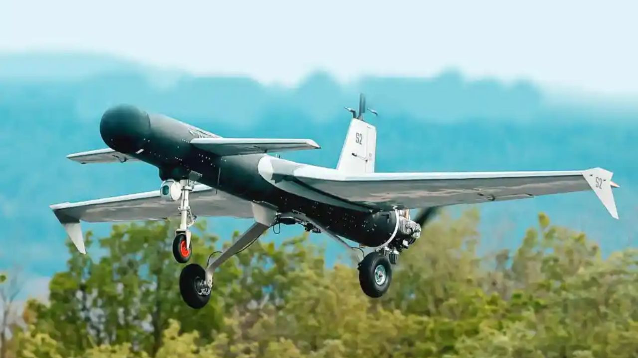
Turkey has introduced AI kamikaze drone MIZRAK. It is a rotating weapon which has a range of 1,000 km, it can fly for 7 hours and its warhead is 40 kg. It works even when GPS is turned off, which can pose a big threat to VIPs. Türkiye’s famous drone company Baykar has recently introduced its new AI-powered kamikaze drone, MIZRAK. meaning of mizraq"Arrow" Or "spear" It happens.
This long-range rotating weapon rotates in the air, finds the target, and then attacks. The range of this drone is more than 1,000 kilometers, it can stay in the air for 7 hours and can carry a warhead weighing up to 40 kg. It will be shown to the general public for the first time at the SAHA 2026 exhibition which will be held in Istanbul from May 5-9, 2026.
How does Mizrak work?
Mizraak is a smart and autonomous drone. Its weight can be up to 200 kg at the time of takeoff. Its wingspan is 4 meters. It can fly at a speed of 185 kilometers per hour and can reach a height of 10,000 feet. It can be launched from a standard runway or with the help of a rocket.
The world’s most dangerous drone
It comes in two variants. One has a 40 kg dual warhead for heavy damage. The second has a 20 kg warhead which has a radio frequency seeker which can easily detect the target through radar. It is also fitted with Baykar’s EO/IR cameras for surveillance and target identification.
This drone does not just fly to attack but keeps hovering in the air to find the right opportunity. It can be combined with other biker drones like TB2, TB3, and AKINCI to carry out swarm attacks.
How does MIZRAK navigate without GPS?
Ordinary drones depend on GPS but if the enemy jams the GPS signal then they become useless. Mizrak solves this problem. It has an AI-powered autopilot system that works without GPS. It includes optical guidance and visual positioning technology.
Sensors inside the drone track its speed, direction and position. AI processes camera images and matches them with nearby maps, buildings, mountains or landmarks to determine your position in real time. Technologies like SLAM help, through which the drone can create its own map and locate itself in it. On reaching the target, AI identifies the target from optical and infrared images.
Comments are closed.