
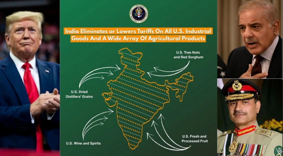
The Office of the United States Trade Representative (USTR) deleted an The map, which was shared along with the announcement of the interim India-US trade agreement framework on February 7, did not have dotted lines, distinct marks or dispute labels for PoK (controlled by Pakistan) and Aksai Chin (claimed by China), which completely matched India’s official cartography.
The post sparked widespread speculation on social media and Indian outlets, with many seeing it as a possible change in Washington’s long-standing position—usually showing PoK with separate borders—to show sensitivity towards Pakistan and China. Experts described this as a departure from previous US statements, sparking debate over whether it was a sign of tacit support amid strengthening bilateral ties under the Trump administration.
By February 11, the entire post disappeared from USTR’s official X account without any explanation or statement. The trade announcement’s larger fact sheet and related content remain available on USTR’s website and other platforms, but the key graphic containing the map was removed, which quickly quelled the controversy.
India says that Jammu and Kashmir (including Ladakh) and Aksai Chin “are, are and will always be integral parts” of its territory and has no reliance on any external validation. The map’s brief appearance was celebrated by some as symbolic support, though experts cautioned that it was probably a mistake in graphic selection rather than an intentional change in policy – given the silent deletion and lack of official commentary.
According to some reports, Pakistan reportedly lodged a diplomatic protest over the showing of disputed areas. The incident highlights the ongoing sensitivity in US-India relations amid a trade reset, even as core bilateral cooperation moves forward.
Comments are closed.