
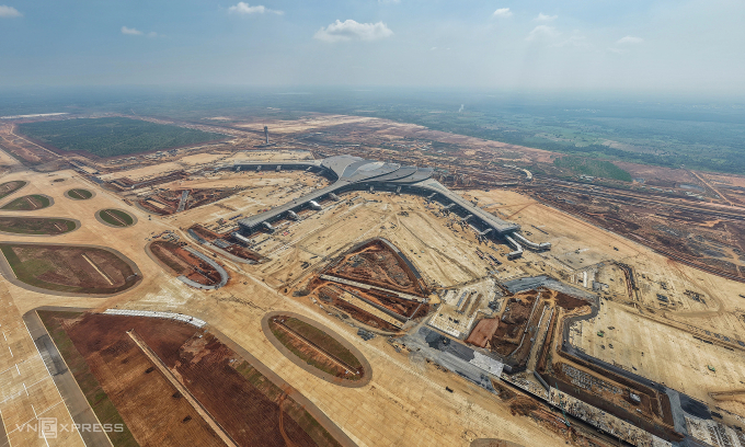
Aerial view of Long Thanh International Airport under construction in Dong Nai Province, southern Vietnam. Photo by Read
Vietnam is approaching a major readiness milestone for Long Thanh International Airport, as the Vietnam Air Traffic Management Corporation (VATM) confirms that all navigation systems, equipment and staffing are now in place for technical test flights scheduled from Dec. 15–19.
According to VATM, key systems supporting flight operations, including communications, navigation, surveillance, meteorology and automated messaging, have been fully deployed and tested to ensure stable 24/7 service. Engineers say the setup follows multilayer safety standards with complete backups for essential components.
On the airfield, the runway 23L/05R, taxiway B and connecting taxiways have been cleared to receive and guide aircraft under real-world operating scenarios.
Working with Boeing, VATM has also refined Long Thanh’s flight procedures to integrate safely with nearby Tan Son Nhat and Bien Hoa airports. The Civil Aviation Authority of Vietnam (CAAV) has approved the procedures for immediate use.
During next week’s test flights, aircraft will perform departures, approaches and landings to validate simultaneous operations between the region’s two major airports.
Air-traffic controllers, technicians, meteorologists and rescue crews have all undergone multi-round training based on operations manuals that meet the latest standards of ICAO and CANSO.
Authorities have also rehearsed emergency scenarios such as loss of communication, aircraft malfunctions, unlawful interference and diversions back to Tan Son Nhat. Controllers at Long Thanh and Tan Son Nhat have been trained to coordinate closely.
CAAV inspectors recently conducted simulator checks with Long Thanh’s controllers, testing responses to bad weather, navigation-system failures and aircraft emergencies. Officials later praised their performance and teamwork.
Long Thanh’s new air-traffic control tower, a lotus-inspired structure rising 123 meters, leads a network of completed facilities including radar stations, VHF transmitters, ADS-B surveillance, weather radar, VOR/DME navigation systems and wind-shear warning equipment spread across 70,000 sq.m.
Comments are closed.