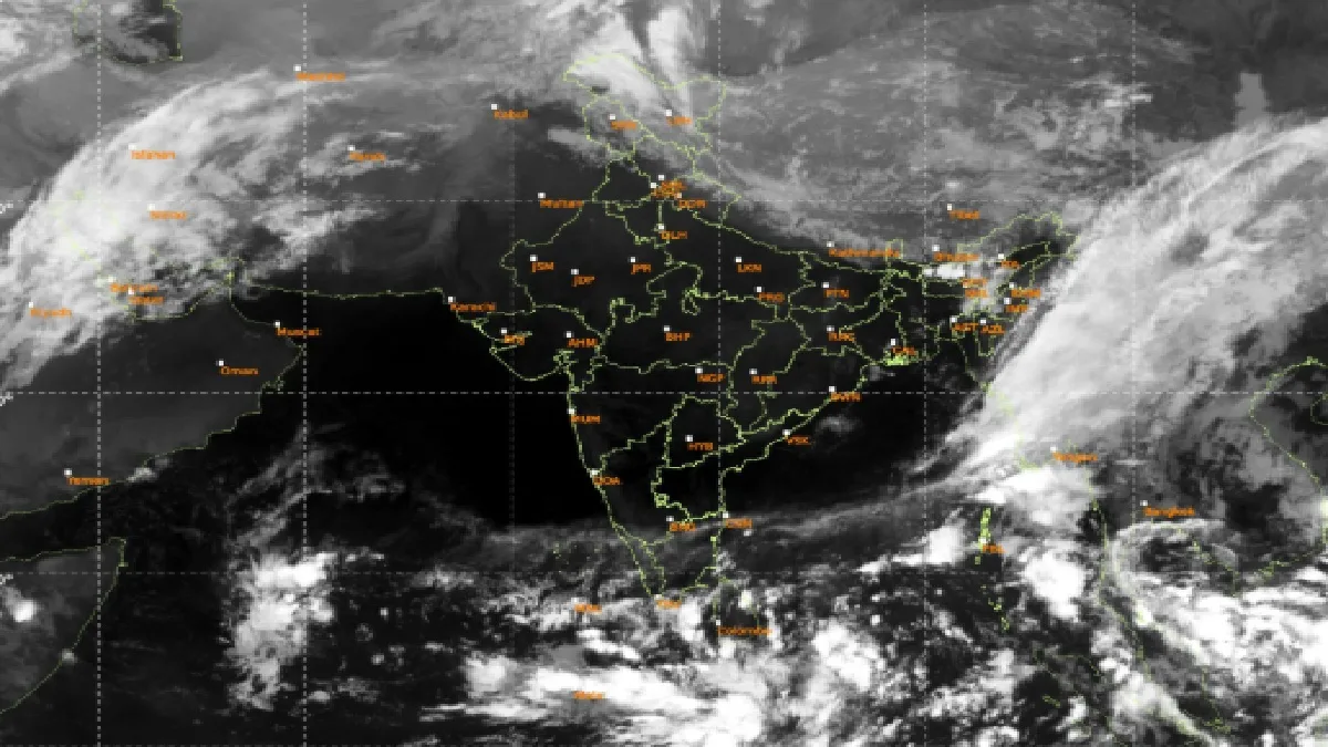
New Delhi. Recently, two cyclones Arnab and Murasu had arisen in the Bay of Bengal. Due to which there was huge loss in some parts of Andhra Pradesh. Now the Meteorological Department has said that there is a possibility of a new low pressure area forming in the Bay of Bengal. This area of low pressure may later become a third cyclone. Which is likely to have a big impact on Tamil Nadu. The Meteorological Department says that a low pressure area may form in the south-east of the Bay of Bengal around November 13. Which will move towards north-west.
According to the Meteorological Department, within 24 hours of the formation of a low pressure area, it will turn into a clear low pressure area. Due to which, winds with a speed of 60 kilometers per hour may blow in the Andaman Sea and south-east Bay of Bengal on 14 and 15 November. The situation in Andaman Sea and south-east Bay of Bengal is likely to become very bad on these dates. Due to which fishermen have been advised not to go into the sea. The unique thing is that there are going to be three cyclones in the Bay of Bengal within a month. This is rarely seen. At the same time, the Meteorological Department has warned of rain, thunder and strong winds in many states from 11 to 16 October.

According to the Meteorological Department, due to western disturbance, there is a possibility of snowfall, rain and thunderstorm in Jammu and Kashmir, Himachal Pradesh and Uttarakhand. Punjab may also receive light rain between 12th and 16th November. There is a possibility of heavy rain and strong winds in Andaman and Nicobar Islands till November 14. There are chances of heavy rain here till November 16. According to the Meteorological Department, there may be light rain in Bihar, Jharkhand, West Bengal and Sikkim. There is a possibility of rain and thundershowers in the northeastern states including Assam. Whereas, the Meteorological Department has also warned of lightning at many places in Meghalaya, Mizoram and Tripura.