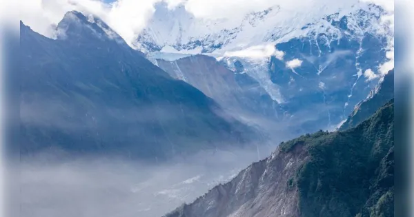
Kathmandu. The part of Langtang Lirung, a Himalayan mountain peak located on the border of Nepal and Tibet, from where glaciers and rocks had slipped and caused devastating floods in Nepalese territory, some part of the glacier and the mountain still exist in an unstable state. It can slip any time.
After the devastating floods in Nepal on August 26, two important indications regarding Langtang Lirung have emerged in the satellite images and data provided by China.
According to this, the glacier and some part of the mountain still exists in an unstable state in the part from which the glacier and rocks had slipped and caused the devastating flood. Apart from this, a lake covered with snow in the same area is now clearly visible.
According to Vikram Shrestha, deputy executive director of the Hydrology and Water Resources Research Centre, recent satellite images received from China show that some part of the glacier is still hanging and may slip in the future.
However, how big this part is and when it will slip has not been determined yet. Therefore, another major avalanche cannot be immediately predicted based on these signals alone.
According to a study by the Tibetan Plateau Research Institute of the Chinese Academy of Sciences, the chunk of ice and rock that slid from Langtang Lirung on August 26 was about 980 meters wide and 780 meters long.
Its area is approximately 0.76 square kilometers and its volume is estimated to be more than 7 crore cubic meters. While moving downwards, this huge debris also carried other rocks and material along with it.
According to experts, satellite analysis has indicated that between August 12 and 24, unusual movement had increased in that hilly part and the rocky part was slipping at the rate of about 0.4 meters per day.
However, this analysis was done after the event and it cannot be said that the avalanche was accurately predicted at that time.
In satellite images, a lake which was earlier covered with ice in the same area is now clearly visible. Its area is approximately 0.19 square kilometers, which is equivalent to approximately 27 international football fields. Currently, there is not enough information available about the depth of the lake and the amount of water present in it.
According to experts, if water seeps from this lake and reaches the cracks of the mountain, it may affect the stability of the rocky part. Therefore, continuous satellite monitoring of the lake and glacier area is considered necessary.
At present, the scientific conclusion is that some ice and rock parts of the mountain peak Langtang Lirung are still unstable, but a definite estimate of the timing, size and possible impact of its slide is not yet available. For this reason, regular monitoring of the area is being considered important.
It is noteworthy that Langtang Lirung is a major Himalayan mountain peak 7,234 meters high located on the border of Nepal and Tibet, which is famous for its extremely steep slopes, ice glaciers and huge rock formations.