
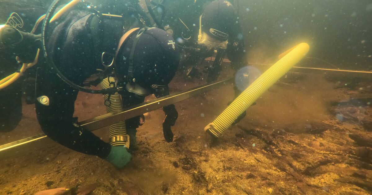

The archaeologists discovered what lay beneath the island (Image: Copyright remains with handout provider)
Archaeologists have employed cutting-edge techniques to unlock the secrets of an artificial island predating Stonehenge in a Scottish loch.
The island in Loch Bhorgastail on the Isle of Lewis appears at first glance to be constructed entirely of stone – yet researchers from the University of Southampton have established that timber formed the foundation of the structure.
Although the presence of some wood beneath the island had previously been acknowledged, the true scale of the timber construction remained undiscovered until excavation and analysis got underway.
During fieldwork at the crannog, archaeologists revealed a layered construction of wood and brushwood beneath the stone, while also recovering hundreds of pieces of Neolithic pottery submerged in the surrounding waters.
University of Southampton archaeologist Dr Stephanie Blankshein said: “When we actually started excavating is when we realised that it was actually this coherent, quite large timber structure that was under what you would see as the stone island today. So that was a big surprise, and that was in 2021 when we actually started digging down.
The foundations had long been a mystery to scientists (Image: Copyright remains with handout provider)
“Before that, we didn’t know. We just knew that there were pieces of wood sticking out and that there must have been some sort of structure there.”
Working alongside experts from the University of Reading, researchers have employed a technique known as stereophotogrammetry – a method of generating 3D computer imagery using multiple 2D photographs – to illustrate how the island appears both above and below the waterline as a single, continuous structure.
Dr Blankshein said: “Through excavating and through the photogrammetry work that we did, we were able to build a picture of this coherent timber structure, not just bits of wood supporting a stone mound with a kind of timber platform underneath, but actually, the timber itself was the basis of the structure.
“A lot of work went into it, we’ve had a lot of really good dates come out of it, and all the dates are aligning to about 3500 to 3300 BC across all the sites we’re seeing. So we know that this was an activity that wasn’t just taking place at this site, but other sites nearby and even on other islands throughout the Outer Hebrides.”
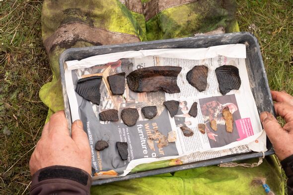
Fragments of Neolithic pottery found on the artificial island (Image: Copyright remains with handout provider)
Crannogs are modest artificial islands typically thousands of years old, hundreds of which are scattered throughout Scotland’s lochs.
Dr Blankshein said: “While we still don’t know exactly why these islands were built, the resources and labour required to construct them suggests not only complex communities capable of such feats, but also the great significance of these sites.”
The archaeologists uncovered the various phases of construction of the crannog throughout several recent years of fieldwork at the site, employing traditional excavation methods, radiocarbon dating, surveying and coring.
They found that it was first built more than 5,000 years ago, beginning as a circular wooden platform, approximately 23 metres wide, covered with brushwood.
Roughly 2,000 years later during the Middle Bronze Age, an additional layer of brushwood and stone was laid down, with further activity occurring around 1,000 years after that during the Iron Age.
A stone causeway, now submerged beneath the water, stretches from the loch shore to the island. The site was first discovered in 2009.
The experts have since offered fresh insight into the crannog using photogrammetry, a process whereby photographs of the subject are captured from numerous different angles and subsequently “stitched” together by specialist software to produce a high resolution digital model.
Conducting photogrammetry in shallow water such as that surrounding the crannog presents considerable challenges, prompting the archaeologists to devise an entirely new technique for doing so during their fieldwork.
Principal investigator and director of the Southampton Marine and Maritime Institute, Professor Fraser Sturt, said: “Fine sediments, choppy conditions, floating vegetation and distorted or reflected light all hinder shallow water imaging.
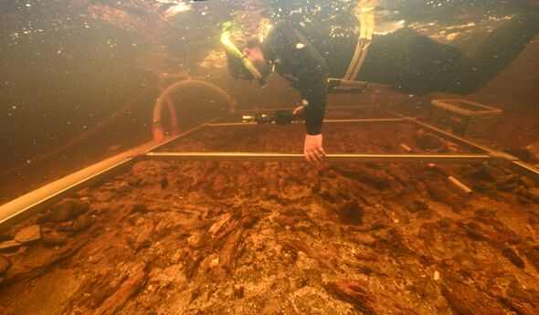
Divers carrying out survey work at Loch Bhorgastail (Image: Copyright remains with handout provider)
“Photogrammetry is very effective in deep water but runs into problems at depths of less than a metre. This problem is a well- known frustration for archaeologists.”
Utilising a method developed during fieldwork in 2021, the researchers employed two compact waterproof cameras – boasting low-light capability and a wide-field of view.
These were secured at a fixed distance apart on a frame, ensuring precise overlapping of imagery to help counteract any missing or disrupted data.
A diver manoeuvred the cameras through the water, with positioning controlled to centimetre accuracy, which is said to match that achieved by an aerial drone.
Their methodology is outlined in a newly published article in the journal Advances in Archaeological Practice.
Comments are closed.