United Nations: India has voted in favour of a UN General Assembly resolution aimed at correcting the world map to promote a more accurate representation of continental landmasses.
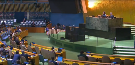
The 193-member UN General Assembly Friday overwhelmingly adopted the resolution ‘Correct the map rebalancing global cartographic representation and promoting equitable representation of the world’s regions, particularly Africa’.
The resolution was sponsored by Togo, receiving 164 votes in favour, with abstentions from Estonia, Georgia, Lithuania, Moldova, Serbia and Ukraine, and a lone vote against from the United States.
The resolution noted that the Mercator projection, designed in the 16th century for navigational purposes, remains widely used in educational, media, digital and official materials, despite the considerable distortion of landmasses to the North and South, far from the equator.
The resolution also noted with concern that this distortion contributes to minimising the perceived sizes of Africa, Latin America and South Asia, and perpetuating an unbalanced view of the world.
In an explanation of the vote in the General Assembly, First Secretary at the Permanent Mission of India to the UN, Raghoo Puri, said India welcomes the intention behind the resolution to promote more accurate and representative cartographic practices.
We believe that maps play an important role in how societies understand geography and the relative scale of the world around us, he said.
However, India clarified its understanding of the scope of this resolution, saying, We believe that the resolution should be understood as supporting the broader use and consideration of Equal Area map projections, and not as endorsing the Equal Earth projection or any other specific map projection.
Equal Area projections are particularly relevant because they preserve the relative sizes or areas of continental and territorial landmasses, Puri said.
This can help address distortions in perceived landmass size that arise from projections designed primarily to preserve other geographic characteristics such as shape, direction, or distance. At the same time, different projections serve different cartographic purposes. No single projection is necessarily appropriate for every application.
Therefore, we believe it is important for this resolution to remain technological and methodological-neutral. Our delegation supports the language that encourages accurate cartographic representation while allowing countries, institutions and cartographers to determine which projection is most appropriate for their specific needs, Puri said.
He said India’s position is limited to the principle of encouraging Equal Area approaches where the objective is to preserve the relative sizes of continental landmasses.
Such an approach would preserve the resolution’s objective while avoiding all unnecessary preference for one particular cartographic methodology or endorsement of any specific projection, including the Equal Earth projection. India has therefore voted in favour of this resolution, he said.
The resolution affirmed that cartographic distortions of continental sizes inherited from history have cognitive, educational, cultural, geopolitical and socioeconomic impacts and constitute historical biases, the correction of which will promote recognition, justice and development, particularly about the African continent.
The resolution declares that the Equal Earth cartographic projection offers a more accurate representation of the sizes of continental landmasses.
The resolution encouraged Member States to promote the use of cartographic representations, depending on the intended use, that more accurately reflect continental sizes and geographical realities, including the Equal Earth cartographic projection.
The Mercator projection is a world map devised in 1569 by Flemish cartographer Gerardus Mercator that does not accurately reflect the actual continental landmasses, making Africa look smaller than it actually is and enhancing the sizes of Northern Europe and North America.
Rejecting the text, Deputy US Representative to the UN Economic and Social Council Yaryna Ferencevych said that instead of focusing on genuine problems of international peace, prosperity, or good relations, the UNGA is debating map projects from the 16th century, and their role in promoting reparations and cognitive justice.
Resolutions like this and the ideological agenda they promote are barnacles on our work here, and the reason this institution is losing its credibility. When the United Nations questions why it is losing legitimacy in the world, and is not taken seriously, time and again, we point to resolutions such as this, Ferencevych said.
Pakistan also voted in favour of the resolution, saying it supports the basic premise of the initiative for an accurate description of the continental landmasses only and not countries’ political maps and boundaries.
This resolution is therefore for educational purposes only, (it) does not alter the legal status of the disputed territories recognised as such by the resolutions of the United Nations Security Council and other international boundaries, Pakistan said.