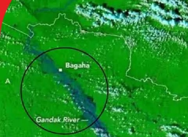
Washington/Patna. The dire flood situation in Bihar is now visible even in pictures taken from space. The Earth Observatory of the American space agency NASA has published a report titled 'Rains Swamp the Gandak River' regarding the unprecedented flood in the Gandak River. Bihar Deputy Chief Minister Vijay Kumar Choudhary also confirmed the record rise in the water level of Gandak River, saying that due to exceptionally heavy rains in Nepal, the water level of the river in parts of Nepal and India reached historic levels.
Villages in six districts are in the grip of floods
After heavy rains in Nepal, the water level of Gandak river rose rapidly, due to which the flood situation in many areas of Bihar became serious. Many villages in West Champaran, East Champaran, Saran, Gopalganj, Vaishali and Muzaffarpur districts have been submerged. Due to floods, people have had to leave their homes and go to safer and higher places.
NASA's Earth Observatory has assessed the extent of flooding in the river and its surrounding areas based on satellite images. The report noted extraordinary water rise in the river, water flowing over embankments and damage to embankments at some places.
Heavy rain in Nepal between 24 and 27 September
According to NASA report, between September 24 and 27, heavy rains occurred in the hilly areas of Lumbini and Gandaki provinces of Nepal. Due to this, incidents of landslides also occurred and the flow of water in Gandak river increased unusually.
The US space agency has used images obtained from MODIS instruments mounted on Terra and Aqua satellites in its report. Through these photographs, the situation of the flood affected areas around the river was assessed.
Water level reached 11.94 meters in Devghat
Bihar Deputy Chief Minister Vijay Kumar Choudhary, citing the NASA report published on October 2, said that the satellite data has helped in understanding the severity of the floods. According to Chaudhary, who is also holding the responsibility of the Water Resources Department, a comparison of satellite images taken on September 20 and September 29 reveals the extent of submerged areas around the Gandak river.
He said that according to the report, the water level of Gandak River reached 11.94 meters in Devghat, Nepal on September 27. This is said to be the highest level since water level measurement started there in the 1960s.
Chaudhary said that due to extraordinary rise in water level in the river, flood water spread over a large area. At many places water started flowing over the embankments, while at some places cracks appeared in the embankments. Scientific and satellite-based data can prove useful in assessing the spread and severity of floods.
More than 28 tons of food items delivered by helicopters
An air campaign is also being conducted to provide relief to the flood affected people in Bihar. According to the state disaster management department, Indian Air Force helicopters flew 15 sorties and delivered more than 5,600 packets of dry ration to the flood-affected areas of Saran district. More than 28 tonnes of food items were distributed through them.
The department said that in this special air relief operation conducted on the instructions of Chief Minister Samrat Chaudhary, the Disaster Management Department of the State Government coordinated with the Union Home Ministry and Defense Ministry.
The challenge of relief and rescue operations remains amid the rising water level of Gandak River in Bihar and the wide spread of floods. NASA satellite images are helping in understanding the extent of water in the flood affected areas, while the administration is busy providing necessary assistance to the affected people.