
UP Weather Update: Severe alert of storm and rain in 30 districts of UP, Meteorological Department issued warning
The weather has once again taken a turn amid the scorching heat in Uttar Pradesh. If you are thinking that there is going to be relief from the scorching sun, then let us tell you that along with relief, there is also going to be trouble. Due to the active Western Disturbance, there will be cloud cover in UP for the next three-four days. According to the Meteorological Department, today i.e. on June 3, there is every possibility of heavy rain in both the western and eastern parts of the state.
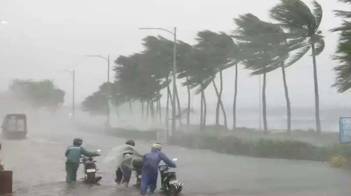
During this period, the weather pattern can be quite aggressive and along with drops of relief from the sky, there can also be a strong dust storm at a speed of 40 to 50 kilometers per hour. In such a situation, there is a strong need to be careful while leaving the house.
Lucknow was humid and Fatehgarh was the hottest.
Talking about the capital Lucknow, the maximum temperature here on Wednesday is expected to be around 40 degrees and the minimum temperature will be around 27 degrees Celsius. Last Tuesday, Fatehgarh district was the hottest in the entire Uttar Pradesh, where the mercury was recorded at 42 degrees Celsius. On the other hand, the nights remained very cold in Najibabad and the minimum temperature there was recorded at 21 degrees Celsius. However, meteorologists say that this relief will not last long. Within the next five days, there may be a huge increase of 6 to 8 degrees in the maximum temperature and 2 to 4 degrees Celsius in the minimum temperature.
Big update on possibility of hail and monsoon
According to the latest report of Zonal Meteorological Centre, Lucknow, thundershowers with lightning are expected in Western Uttar Pradesh till June 6. Whereas in eastern Uttar Pradesh the weather will remain like this till June 7. During this time, there is an alert of lightning and destructive winds blowing at a speed of 40 to 60 kilometers per hour in some areas. The Meteorological Department has warned that hailstorm may also occur at some places.
But the real tension will start after June 7, when the mercury will once again rise in the state and a severe heat wave will start. Along with this, this time the people of UP will have to wait a little longer for the monsoon. Generally, monsoon enters the state between 15th to 20th June, but this year it is expected to arrive only between 20th to 25th June or later.
Today there will be heavy rain in more than 30 districts
Cloud movement and rain will continue in a large part of Uttar Pradesh on Wednesday. The districts where the highest probability of rain has been expressed are Saharanpur, Shamli, Muzaffarnagar, Baghpat, Meerut, Ghaziabad, Hapur, Amroha, Bijnor, Lalitpur, Jhansi, Hamirpur, Mahoba, Banda, Fatehpur, Rae Bareli, Chitrakoot, Kaushambi, Prayagraj, Pratapgarh, Amethi, Sultanpur, Sant Ravidas Nagar, Jaunpur, Mirzapur, Varanasi, Azamgarh, Ambedkar Nagar, Mau, Ghazipur, Chandauli and Sonbhadra are included.
Apart from this, special alert of lightning and thunder has been issued at some places in Noida, Ghaziabad, Hapur, Amroha, Meerut, Baghpat, Muzaffarnagar, Bijnor, Shamli and Saharanpur. Whereas in Jhansi, Lalitpur, Mahoba, Hamirpur, Banda, Fatehpur, Rae Bareli, Amethi, Pratapgarh, Kaushambi, Chitrakoot, Prayagraj, Sultanpur, Ambedkar Nagar, Azamgarh, Mau, Ballia, Ghazipur, Varanasi, Jaunpur, Chandauli, Sant Ravidas Nagar, Mirzapur and Sonbhadra of Bundelkhand and Purvanchal. There may be rain and thundershowers.
Comments are closed.