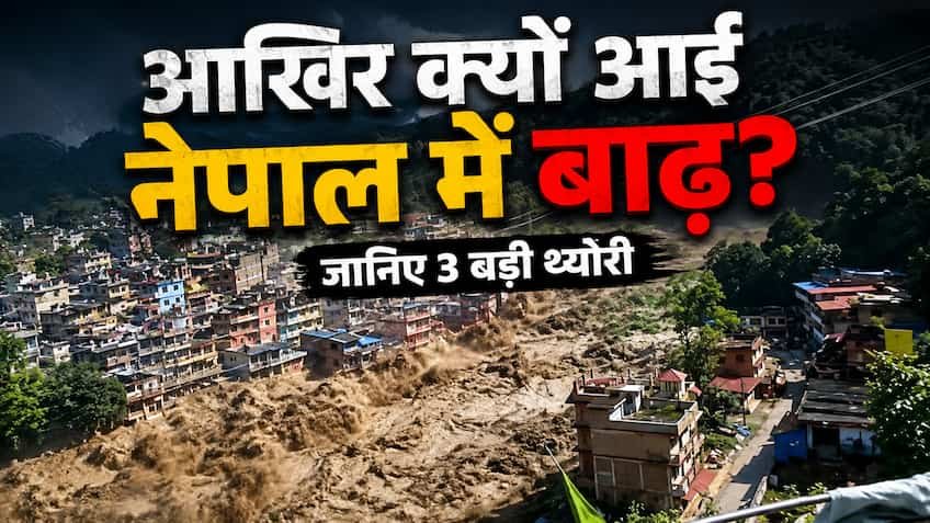
The sudden deluge and massive landslide in the neighboring country Nepal, situated in the lap of the Himalayas, has attracted the attention of the whole world. The surging rivers, multi-storey buildings collapsing like cards, floating bridges and beautiful hill towns turning into debris are testifying to some terrible tragedy. The big question echoing in everyone's mind is, where did so much water and debris come from suddenly without any long warning? Reports coming from ground zero and research by geologists clearly indicate that this devastation is not just a result of seasonal rains, but a dangerous cocktail of nature's delicate balance, the impact of past great earthquakes, rapidly melting glacier lakes and unplanned human development is responsible for it. Rainfall from the Sky: Cloudbursts and Unusual Monsoon Pressure Nepal's unique topography acts as a natural wall against monsoon winds. When the extremely moist monsoon winds rising from the Bay of Bengal and the Arabian Sea move north, they hit the high peaks of the Himalayas. In meteorology it is called 'orographic lifting'. In recent times, a rare combination of Western Disturbance and Monsoon Trough has resulted in excessive accumulation of clouds over narrow mountain valleys, leading to 'cloudburst' like incidents in many areas. When more than 200 to 300 mm of rainfall is recorded over a small geographical area in a very short period of time, on mountains with steep slopes the water has no chance to seep into the ground. All this water flows at great speed on the surface and flows into major rivers like Bagmati, Kosi, Narayani, Gandaki and Karnali. As a result, seemingly calm rivers turn violent within minutes and engulf coastal towns, markets and agricultural lands in their path. Creepy connection of Glacier Lake: When natural dams burst on top of mountains To understand the depth of this terrible disaster, we have to look towards the high Himalayan peaks of Nepal, where hundreds of glaciers are present. Due to global warming and climate change, Himalayan glaciers are melting at a historic pace. When glaciers retreat, they leave behind a natural barrier of soil, sand and large stones at their mouth, which is called a 'moraine' in geology. Behind this debris, giant lakes are formed from the melted ice water. When the water level in these lakes crosses the danger mark, or a huge avalanche or rock falls directly into the lake from the upper part of the mountain, this crude dam of moraine suddenly breaks. This is called 'Glacial Lake Outburst Flood' (GLOF). When millions of cubic meters of water falls down extremely steep slopes, it carries with it mountain soil and huge boulders. This debris flow creates tsunami-like waves in the valleys below, destroying entire villages and hydroelectric projects without any prior warning. The great earthquake of 2015 and the weakened Himalayan land structure. The roots of this disaster are also directly related to the seismic history of Nepal. Nepal is located in a highly sensitive tectonic zone, where the Indian Plate is continuously sliding beneath the Eurasian Plate. The devastating 7.8 magnitude Gorkha earthquake in 2015 and hundreds of aftershocks that followed shook and hollowed out the internal rock structure of the entire Himalayan region. Due to the strong tremors of the earthquake, countless microscopic cracks were formed inside the mountains, which are not visible to the normal eye. When water from torrential monsoon rains penetrates into the depths through these cracks, the mutual friction between the rocks is lost. As a result, big mountains start falling like a deck of cards. Such incidents are called 'seismically triggered landslides', which increased the speed and intensity of the devastation in Nepal manifold this time. Landslide dams suffocating rivers and sudden flash floods Another dangerous phenomenon was seen in this flood of Nepal, which geologists call 'Landslide Dammed Lake Outburst'. When thousands of tons of debris and stones fall from mountains, they often completely block the natural flow of rivers flowing through narrow valleys. Due to this, a huge artificial lake is formed behind the river within a few hours. Local residents in the downstream areas feel that the water level of the river has suddenly decreased, but in reality a huge water bomb is being prepared above. As the pressure of the water accumulated behind increases, this weak natural barrier of soil and stones suddenly bursts. When the barrier breaks, the accumulated water gushes downwards in the form of a flood. This is the reason why people do not get time to run to safe places and low-lying areas are suddenly filled with several feet of water. Indiscriminate development and encroachment of river banks have made this natural disaster more deadly due to human mistakes. In the last few decades, roads were laid, tunnels were dug and settlements were established on the floodplains of rivers in the hilly and Terai areas of Nepal without any solid geological and environmental studies. When mountain slopes are cut in an unscientific manner with heavy machines, the mountains lose their natural stability. In addition, construction work on the natural drainage channels and embankments of the rivers made the rivers narrower. When abnormal rains and glacier water came together, the rivers had no space to spread, due to which the water directly engulfed residential colonies, government buildings and roads. Unplanned garbage disposal and indiscriminate deforestation also deepened the crisis by reducing the water holding capacity of the soil. Cross-border impact: Threat looming over the Terai areas of India. The impact of this devastation in Nepal is not limited to the borders of Nepal only. Most of the major rivers of Nepal flow into the northern states of India, especially Bihar, Uttar Pradesh and West Bengal. Due to this severe flood in the catchment areas of Nepal, the water level of rivers like Kosi, Gandaki and Ghaghra crosses the danger mark, causing high alert and serious flood crisis in the Indian border districts also. This underlines the need to further strengthen the system of sharing real-time weather and water-flow data between the two countries to deal with this common disaster. The Way Forward: Early Warning Systems and Sustainable Himalayan Policies This disaster in Nepal is a serious warning for the entire Himalayan region. In this era of climate change, 24×7 satellite based monitoring of glacier lakes, installation of high-tech early warning systems and scientific control on large construction works in sensitive seismic zones have become extremely necessary to reduce future losses. Unless sustainable development policies are adopted while respecting the laws of nature, the threat of such unexpected disasters will continue to loom over the Himalayan valleys.