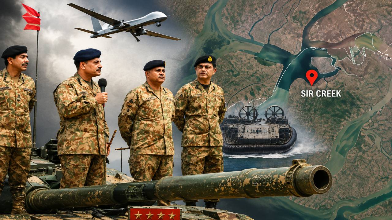
456 days after Operation Sindoor, reports of increased Pakistani military activity in the Sir Creek area, also known as Harami Nala, bordering Gujarat’s Kutch region, have once again sparked discussions about tensions along the India-Pakistan border. According to reports, Pakistan has increased the deployment of troops and military equipment around Sir Creek. This deployment has been dubbed “Project Ababil” by Pakistan. It is reported that commandos, Turkish-made drones, and Chinese hovercraft have been deployed in the area as part of this operation.
The question is: why has Pakistan suddenly increased its military presence in the difficult and dangerous terrain of Sir Creek? Is this merely an attempt to demonstrate strength, or is there a deeper strategy behind it? How can India address this situation? To understand these questions, it is first necessary to understand what Sir Creek and Harami Nala are and why they hold such strategic importance.
What is Harami Nala?
Harami Nala is a 22-kilometer-long tidal waterway located in the Sir Creek region. It is part of a long-standing maritime boundary dispute between India and Pakistan. The area is connected by numerous creeks and waterways. The Viyan Wari Creek, flowing into Indian territory, continues north into Pakistan, where it is known as the Harami Dhodo. It then turns east and re-enters India as the Harami Nala. It further divides into several smaller streams and flows into the marshy Rann of Kutch.
In some places, this waterway is only about 1.5 kilometers wide. Surrounded by mudflats, mangroves, and shallow tidal creeks, this area is considered one of the most difficult on the western border of India and Pakistan.
Why did Pakistan suddenly increase its activity in Sir Creek?
According to reports, such deployments can be influenced by the geographical and environmental conditions of an area. They suggest that Pakistan has previously employed the strategy of expanding its presence in difficult terrain. Pakistan has also previously increased its military presence in the Kargil region, where heavy snowfall makes military operations extremely difficult during winter. It is believed that capturing a portion of the area could provide Pakistan access to the Arabian Sea, potentially detrimental to India.
It is believed that a similar strategy may be adopted in Sir Creek. The current monsoon season has made the Sir Creek area even more difficult. Therefore, securing a position in a difficult area early and making it more difficult for another party to dislodge it later.
What are the reasons behind Pakistan’s deployment?
The first reason is the difficult geography of Sir Creek. During the monsoon, the area becomes even more marshy and waterlogged. This makes deployment difficult, but once troops and equipment are established, removing them can be even more difficult. Another reason could be threat perception. Generally, more troops and military equipment are deployed in an area where the threat of an attack or infiltration is considered more serious.
A third reason is being cited as Pakistan’s internal politics. Amidst the election atmosphere in Pakistan-occupied Kashmir (PoK), there is talk of discontent against the government and the military. In such a situation, speculation has emerged that an aggressive image of the military is being used to divert public attention from other issues.
The fourth reason is said to be related to the geopolitical situation. Pakistan considers itself in a strong position due to its role as a mediator between the Iran and the US war. Consequently, it is being speculated that Pakistan may attempt to demonstrate its military strength.
Did Rajnath Singh’s warning have any effect?
On October 2, 2025, on the occasion of Gandhi Jayanti and Dussehra, Defense Minister Rajnath Singh visited the Bhuj military base in Gujarat. During this visit, he warned Pakistan regarding the Sir Creek dispute. Rajnath Singh stated that India had repeatedly attempted to resolve the dispute through dialogue, but Pakistan’s actions indicated otherwise. He warned that any misadventure by Pakistan would face a response so strong that it would impact its history and geography.
What is Pakistan’s ‘Project Ababil’?
The Ababil is a bird that flies high in the sky and has a very high speed. According to Islamic beliefs, these birds aided the Prophet Muhammad’s army during a battle. During this battle, these birds carried pebbles in their mouths and threw them, which struck the enemy elephants with such force that they fled. A medium-range ballistic missile from Pakistan is also named Ababil.
How is Pakistan deploying at Harami Nala?
- The Pakistan Navy’s Special Service Group (SSG-N) is trained for high-risk missions at sea, on land, and in the air. According to reports, commandos from this unit have also been deployed in Sir Creek. It has been reported that after completing military service, some personnel are also inducted into the ISI’s Covert Action Division (CAD).
- The deployment is also said to include Turkish-made armed drones. These can be used for long-range surveillance, imagery, and relaying information to the Pakistani military. If necessary, they can also be used for precision strikes.
- Hovercrafts could prove crucial in the marshy terrain of Sir Creek. They can navigate both water and mud and marshy ground. Their ability to navigate shallow and narrow waterways makes them ideal for this area.
- The high-speed boats can be used for maritime surveillance and rapid movement along the Gujarat coast. They can also be used for rapid return after operations.
- Surface vessels are used for maritime surveillance, patrols, and military exercises. They could enhance the ability to monitor activities in the Sir Creek area.
Why is Sir Creek so important to India?
Sir Creek is a tidal estuary approximately 96 kilometers long. It forms part of the India-Pakistan border between the Kutch region of Gujarat and the Sindh province of Pakistan. The entire area is filled with mudflats, marshlands, and tidal waterways, making normal navigation extremely difficult. The situation becomes even more difficult during the monsoon season. Rainwater mixes with tidal waters from the Arabian Sea, flooding large areas and further destabilizing the marshlands.
Walking in these muddy areas can be risky, as one can easily become stuck in the mud. This makes monitoring and patrolling the area challenging.
What is the strategic importance of Sir Creek?
Sir Creek is located near Pakistan’s southern coast and the Karachi region. Due to its proximity to major sea routes, this area is strategically important for both India and Pakistan. For India, monitoring Sir Creek is crucial for border security and maritime surveillance. The creeks and difficult terrain present there are susceptible to being exploited for infiltration, illegal movement, or smuggling.
There have been incidents of Pakistani fishing boats and other vessels being caught in and around Sir Creek. Therefore, constant surveillance of this entire area is considered essential.
Why is it so difficult to set boundaries?
The Sir Creek region is directly affected by tides, and some areas remain submerged for large parts of the year. The direction and nature of the currents change with the tides. The marshy terrain makes it difficult to establish and monitor a permanent and clear boundary. Furthermore, snakes, scorpions, and various fish species are found here, adding to the challenges for security personnel working in this area.
Oil and gas reserves also increase importance
The Sir Creek region is also said to contain potential oil and natural gas reserves. This adds economic significance to the dispute. This means that the Sir Creek area is not just a border security issue; it also involves maritime security, potential energy resources, and territorial claims between India and Pakistan.
What options does India have now?
Anticipating potential threats in the Sir Creek region, India is already strengthening its infrastructure and security. The presence and preparedness of the BSF, Indian Navy, and Indian Coast Guard have also been increased. The biggest question now is what India’s response will be if Pakistan continues to increase its military presence in the area.