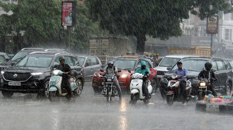
There is going to be a tremendous collision of two opposite weather systems simultaneously in the atmosphere of the Indian subcontinent on 16 October. On one hand, the North-East Monsoon has made an aggressive knock on Peninsular India just after the departure of the South-West Monsoon from the entire country on October 15, while on the other hand, the impact of Western Disturbance and local cyclonic circulation in the troposphere of North and Central India has deepened. According to the latest All India Weather Bulletin issued by the India Meteorological Department (IMD), tomorrow i.e. on October 16, strong thunderstorms, lightning and rain will continue in more than 15 states of the country. While the North-East Monsoon may cause flood-like conditions along with torrential rains in the coastal areas of South India, the plains of North India – especially Delhi-NCR, Western Uttar Pradesh, Haryana and Rajasthan – will see dusty winds and light to moderate rain along with thunderstorms. Due to this sudden seasonal change in the atmosphere, the maximum temperature is expected to drop by 2 to 4 degrees Celsius in most parts of the country. Orange alert of torrential rain in 5 southern states: Danger of waterlogging from Tamil Nadu to Kerala. With the formal onset of north-east monsoon, a pronounced cyclonic circulation has been established over the south-western part of the Bay of Bengal and southern coastal Tamil Nadu. Due to its impact, a strict warning of widespread to very heavy rainfall has been issued in large areas of Tamil Nadu, Puducherry, Karaikal, Kerala, Coastal Andhra Pradesh, Rayalaseema and South Interior Karnataka on October 16. The weather department has issued an orange alert for coastal districts like Chennai, Kanchipuram, Chengalpattu, Tiruvallur, Cuddalore and Thanjavur and directed the district administrations to remain on high alert. In these areas, gale-force coastal winds can blow at a speed of 45 to 55 kilometers per hour and gusts up to 65 km/hour. Severe waterlogging in low-lying residential areas, traffic jams on roads and partial disruption in rail and air services are expected. In Ernakulam, Idukki, Thrissur and Kottayam districts of Kerala, tourists and local residents have been strictly advised to avoid unnecessary travel in view of the danger of landslides on the slopes of the Western Ghats. Rain with thunder and lightning in Delhi-NCR and UP on October 16: Warning of 50 km/hour storm and lightning. Talking about the plains of North India, the country's capital Delhi and the National Capital Region (Noida, Ghaziabad, Gurugram, Faridabad) will be covered with dense dark clouds throughout the day tomorrow. Due to the combined effect of the cyclonic circulation formed in southern Haryana and surrounding areas and the trough line extending from north-eastern Uttar Pradesh to the Arabian Sea, there is a strong possibility of heavy showers with thunderstorms in the afternoon or evening. During this period, strong gusty winds may blow at a speed of 40 to 50 kilometers per hour in Delhi-NCR. Tomorrow's maximum temperature in Delhi is expected to drop to 30 degrees Celsius and the minimum temperature to 21 degrees Celsius. At the same time, in the western and central districts of Uttar Pradesh – Saharanpur, Muzaffarnagar, Meerut, Aligarh, Mathura, Agra, Bareilly, Kanpur and the capital Lucknow, there is an alert of drizzle and sporadic rain along with thunderstorms and loud thunder. The maximum temperature in Lucknow on October 16 is likely to be around 32 degrees and the minimum will be around 22 degrees Celsius. The Meteorological Department has warned that there will be a danger of lightning (thunderstorm) falling in open fields, so do not take shelter under trees or near electric poles during rain. Snowfall on the mountains and falling mercury in the plains: Western Disturbance increases shivering, pink cold arrives before time. Due to the effect of an active Western Disturbance, the high Himalayan regions of Jammu-Kashmir, Ladakh, Himachal Pradesh and Uttarakhand are facing the double blow of snowfall and rain. Fresh snowfall has been recorded in the last 24 hours on Zojila Pass, Gulmarg, Sonmarg, Rohtang Pass and higher peaks of Chamoli-Uttarakashi. On October 16 also, intermittent snowfall and heavy rain will continue in the areas of Manali, Kullu, Lahaul-Spiti of Himachal Pradesh and Kedarnath, Badrinath, Gangotri and Hemkund Sahib of Uttarakhand. The minimum temperature in Manali is expected to drop to minus 3 degrees Celsius, while the mercury in Srinagar may drop to 8 degrees Celsius. These icy and moist winds descending from the mountains have dropped the night temperatures rapidly in Amritsar, Ludhiana, Jalandhar of Punjab and Karnal, Hisar, Ambala of Haryana. In the plains of North India, people have slowed down the speed of fans and have started using light sheets at night and early morning, which is a clear indication that this year's harsh winter is going to arrive before time. Weather patterns in Madhya Pradesh, Rajasthan, Bihar and Odisha: Where will the storm blow and where will the sky remain clear? If we analyze the weather of other major states of the country, there are chances of sporadic rain with winds of 30 to 40 km/hour in Jaipur, Dausa, Alwar and Bharatpur divisions of Eastern Rajasthan on October 16, while the weather will remain dry in Jaisalmer and Barmer of Western Rajasthan. Due to local convection clouds in Gwalior, Chambal, Bhopal and Ujjain divisions of Madhya Pradesh, light rain with thunderstorms and gusty winds at a speed of 50 km/hour are forecast in the evening. There is also a possibility of lightning and light to moderate rainfall in Bilaspur, Raipur and Bastar region of neighboring state Chhattisgarh. Talking about Bihar, the weather is likely to be mainly clear and dry in Patna, Gaya, Muzaffarpur and Bhagalpur on October 16, although scattered cloud movement may be seen in the northern border districts. A yellow alert has been issued for heavy rains with strong winds due to moisture-laden winds coming from the Bay of Bengal in Balasore, Bhadrak, Puri and Bhubaneswar in the eastern coastal state of Odisha. There will be clouds in Kolkata and coastal Twenty-four Parganas districts of West Bengal and intermittent showers will provide some relief from the humidity. IMD's special advisory for farmers and general public: Measures to protect harvested crops and protection from lightning In view of this unpredictable and violent nature of weather, the Agricultural Meteorology Division has issued special guidelines for the farmers of the country. These days, farmers of North India who have harvested Kharif crops – especially paddy, maize, millet and soybean – should immediately take the harvested crops to higher and safe places covered with tarpaulin instead of leaving them in open fields. An appeal has been made to cover grain sacks kept in the open in agricultural markets with waterproof plastic sheets so that the quality of the crop does not deteriorate due to getting wet. Additionally, it has been advised to maintain drains in South India to store north-east monsoon water in paddy fields. For the general public, the National Disaster Management Authority (NDMA) and the Meteorological Department have reiterated the basic rules of protection from lightning and storm. Avoid standing under old dilapidated houses, hoardings, big trees and tin sheds during storms. Unplug electronic devices during thunderstorms and two-wheeler drivers have been advised to slow down on bridges or flyovers during strong winds and rain. October 16 is going to witness seasonal ups and downs across the country, so be sure to check the local weather forecast accurately before leaving home.