
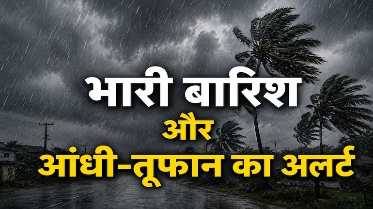
Today’s weather (June 15): Red alert of heavy rain in 9 states of the country, warning of severe thunderstorm and lightning in more than 20 states including UP-Rajasthan.
The Indian Meteorological Department (IMD) has issued a nationwide high alert regarding the weather today i.e. 15 June 2026. South-West Monsoon is progressing at a very aggressive pace in many parts of the country. According to meteorologists, the Northern Limit of Monsoon (NLM) is currently passing through Harnai and Solapur in Maharashtra, Hyderabad, Bhadradri Kothagudem, Kalingapatnam, Paradip, Baripada, Purulia, Dhanbad and Muzaffarpur in Bihar. IMD estimates that within the next 4 to 5 days, monsoon will completely cover the remaining parts of Maharashtra, Karnataka, Telangana, Andhra Pradesh, West Bengal, Odisha, Jharkhand, Bihar and South Chhattisgarh. Due to this tremendous activity of monsoon and cyclonic winds, there is an alert of torrential rain in 9 states of the country today, while in more than 20 states including Uttar Pradesh, Bihar, Madhya Pradesh and Rajasthan, a serious warning of destructive thundersquall and lightning has been issued with a speed of 60 to 80 kilometers per hour. Today there will be heavy rain at these 9 places (Heavy Rainfall Alert) According to the latest satellite report of the Meteorological Department, today on June 15, the north-eastern states of the country and the hilly and sub-Himalayan areas of Eastern India are going to be hit hardest by the monsoon. There is a strong possibility of torrential rain at isolated places over the following 9 regions: Northeast India: 1. Arunachal Pradesh, 2. Assam, 3. Meghalaya, 4. Nagaland, 5. Manipur, 6. Mizoram, 7. Tripura. Eastern India: 8. Sub-Himalayan West Bengal, 9. Sikkim. Warning: There is a serious possibility of heavy rains along with frequent thundershowers, torrential downpours and lightning in all these northeastern states and hilly areas of Bengal-Sikkim, due to which the local administration has been asked to remain alert. Dangerous storm with speed of 60-80 kmph in Rajasthan, UP and MP. Wind direction can be extremely dangerous, violent and destructive in the plains of North-West and Central India today. The Meteorological Department has issued a special ‘Thundersquall Alert’ for these areas, where the dust storm can damage trees and electric poles: Rajasthan (80 kmph superstorm): The most severe sand storm is expected in Rajasthan today. Thundersquall will blow at a speed of 60 to 70 kilometers per hour in many parts of the state, whose gusty winds can touch the speed of 80 kilometers per hour. There will be severe dust storm especially in the districts of Western Rajasthan. Eastern Uttar Pradesh: There is a double warning of strong gale with speed of 50 to 60 kmph (gusts up to 70 kmph) accompanied by torrential rain and lightning in the districts of Eastern UP today. West Madhya Pradesh and Odisha: The weather pattern will be very bad in different parts of these two states today. Today, there will be thunderstorms, thunderstorms and lightning with a speed of 50-60 km per hour throughout the day. Complete chart of thunderstorms and gusty winds in 20+ states of the country According to IMD’s National Bulletin, widespread impact of thunderstorms and gusty winds with speed of 40 to 50 km per hour will be seen in more than 20 states of the country today: Name of the region Affected states and union territories Type of weather and wind speed North-West India Punjab, Haryana, Chandigarh, Delhi-NCR, Western North Pradesh, Himachal Pradesh, Uttarakhand, and Jammu-Kashmir-Ladakh. Winds blowing at a speed of 40-50 kmph, thunderstorms and dust storms. Eastern and Central India Bihar, Jharkhand, Chhattisgarh, eastern Madhya Pradesh and Vidarbha region of Maharashtra. A period of storm and thunder with strong winds. West and South India Central Maharashtra, Andaman and Nicobar Islands, Tamil Nadu, Puducherry and Karaikal. Strong winds with speed of 40-50 km/hr and lightning expected. Low intensity areas: Andhra Pradesh, South Interior Karnataka and Telangana. Scattered thunderstorms with slow winds reaching 30-40 km/hr. On one side there is storm and on the other side there is the torture of heat wave (loo), the mood of Indian weather has completely changed at this time. While half of the country is experiencing the season of storms and rains, in some parts, the fierce Sun God’s wrath and scorching heat wave will still continue to wreak havoc: Heat Wave: Severe heat wave conditions will continue during the day in different rural areas of Marathwada and Vidarbha of Maharashtra. Humidity in Konkan and Goa: The weather is going to be extremely hot, sticky and humid in the coastal areas of Konkan, Goa and Central Maharashtra today. There is a possibility of ‘warm nights’ in some parts of Konkan and Goa today, due to which cooler-ACs will prove ineffective even at night and restlessness will increase. Warning of huge increase in temperature: There is a possibility of a gradual large increase of 4 to 6 degrees Celsius in the maximum temperature in North-West India (which includes Delhi, Punjab, Haryana) by June 18, due to which the dry heat will once again make a comeback. ‘Red Alert’ for fishermen going into the sea: Ban till June 19 In view of the serious threat of bad weather, high tides and stormy cyclonic winds, the Meteorological Department has issued strict instructions to fishermen not to venture into the sea from June 15 to June 19, 2026 (Red Alert). Hazardous sea areas: Strong gale winds reaching speeds of 45 to 55 kmph (gusts up to 65 kmph) will occur over southwest and west-central Arabian Sea off Somalia coast and northwest Arabian Sea off Oman coast. Apart from this, the sea will be very rough with a speed of 40-50 km per hour in the Gulf of Mannar, Comorin area, Sri Lanka coast, many parts of the Bay of Bengal, Odisha coast, Andaman Sea and areas along the South Myanmar coast. Fishermen have been asked to stay away from all these areas immediately.
Comments are closed.