
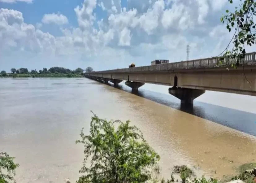

The Yamuna river flowing through Delhi has lost a large part of its original form in the last 200 years. A new research by researchers from Delhi University and Indian Institute of Science Education and Research (IISER), Bhopal has revealed a worrying decline in the size and water flow of the river. According to research, the average width of Yamuna river in Delhi has decreased by about 68%, while the water flow (discharge) of the river has decreased by 89%. Researchers say that the natural form of the river has been continuously affected over time. Research has shown that the main reason behind this change in Yamuna is the cumulative effect of construction of dams, embankments and canals. These structures restricted the natural flow and spread of the river, causing its size to continually shrink.
This study, published in the Journal of Geological Society of India, has done a detailed analysis of the 50 km long Yamuna river area of Delhi. Researchers used historical maps from 1799, old topographic surveys, satellite imagery and data related to river width for this study. With the help of all these sources, a scientific assessment of the changes in the form of Yamuna in the last 200 years was done.
According to research, the average width of Yamuna river in Delhi has decreased by about 68 percent, while the water flow (discharge) of the river has declined by about 89 percent. The study said the cumulative effect of construction of dams, embankments and canals has seriously affected the natural flow and form of the river. Professor Sampat Kumar Tandon of Delhi University, researcher Tanya and Kumar Gaurav of Indian Institute of Science Education and Research (IISER), Bhopal were involved in this research.
According to research, in the year 1799 the average width of Yamuna river was about 658 meters, which has now reduced to about 210 meters. That means the width of the river has decreased by about 68 percent in two centuries. During the same period, a huge decline in the estimated water flow (discharge) of the river was also recorded. According to the study, earlier about 30,000 cubic meters of water flowed per second in Yamuna, which has now reduced to about 3,900 cubic meters per second. This represents a reduction of approximately 89 percent.
Research has recorded the decline in the average width of Yamuna based on the data of different years:
1799 647 meters
1893 531 meters
1924 338 meters
1955 223 meters
2020 210 meters
According to researchers, many reasons were responsible for the change in the form of Yamuna river during this period. These mainly include continuous reduction in river width, drastic decline in water flow, reduction of channel bars (sandy islands), and construction of embankments and urban encroachment.
According to research, Tajewala, Hathnikund, Wazirabad, ITO and Okhla barrages, construction of various canals, development of embankments and rapid urbanization are the main reasons for the decline in the width and water flow of Yamuna. According to Vimal Singh, co-author of the research and Professor of Geology Department, Delhi University, a large part of the Yamuna is already diverted due to the barrages and canals built in the upper reaches. Due to this, when the river reaches Delhi, the amount of water in it remains very less. Professor Vimal Singh said that as the population of Delhi increased, the city also expanded rapidly. Since floods occur only for 15 days to one month in a year, people started encroaching on the flood area considering it as vacant land. Due to this, the natural spread of the river continued to shrink.
Major timeline of changes in Yamuna
1799: Mention of free flowing Yamuna in historical maps.
1873: Construction of Tajewala Barrage.
1874: Construction of Okhla Barrage.
1959: Wazirabad Barrage built.
1967: ITO Barrage constructed.
1999: Construction of Hathnikund Barrage.
2023: Record water level of Yamuna recorded in Delhi.
According to the research, the construction of these structures and increasing urban expansion disrupted the natural flow of Yamuna, causing the river’s width and water flow to continuously decrease.
Why did the risk of flood increase?
The study states that in the last 100 years, about one-third of the Yamuna’s floodplain has been cut off from the river due to embankments and urban construction. Due to this, the natural ability of the river to absorb excess water has weakened.
According to the study, the highest ever water level of Yamuna was recorded in Delhi in 2023, while the maximum water flow of the river at that time was lower than the severe flood of 1978. Research has shown that the main reason behind this is the construction of embankments and increasing encroachment on the floodplain. Due to these reasons, the flood water could not spread in the natural flood area of the river and remained confined to the narrow river channel. As a result the water level rose rapidly and reached record levels. In the study, researchers have concluded that Yamuna has now taken the form of a ‘lower flow’ river. He says that in the last two hundred years, due to barrages, canals, embankments and urbanization, the natural flow and expansion of the river has continuously decreased.
Follow the LALLURAM.COM MP channel on WhatsApp

Comments are closed.